Friday, 10 June 2011

Athassel Abbey Co Tipperary


     Above Image: The Cloister

       Above Image: The Stone roof


    Above Image: The eerie stone carvings

      Above Image: The Medieval Bridge


        Above Image: The gate is locked. The wooden stile
                           can be seen to the right of the gate


Athassel Abbey was founded for the Augustinians by William Fitz-Aldhem deBurgho in 1192AD. It grew over the next three centuries to become the largest Abbey in Ireland. It covered almost four acres of land and so important was it, that a town grew up around it. The town has now disappeared but the remains of the Abbey express the greatness of this site. It is off the beaten track and not as heavily advertised as other Abbeys so don't be surprised if you find yourself alone on your visit.
Throughout it's history it was burned twice. Once in 1329 and again in 1581. Finally it was dissolved in 1537 and lands granted to Thomas the Earl of Ormond who neglected the Abbey and subsequently allowed it to fall into ruin.
When you first lay eyes on the Abbey, it looks fairly innocuous, lying in a cattle pasture. It is only when you reach its gatehouse that you begin to perceive how huge this site was. There are vaulted aisles in the nave along with gravestones dating from de Burgho himself up to recent times. We saw a grave stone dated 2008, so the Abbey was still used for this purpose up to modern times.
You enter the Abbey by way of a medieval bridge which crosses a sometimes dried up tributary of the nearby Suir river. You will need to cross a wooden stile in the fence to the right of the padlocked gate. Once in, you will see right through the nave and the vaulted archway to the altar at the rear of the church. The church is almost 200 feet in length and there are two side chapels in each transept.
We have come across large monastic sites before, Bective and Fore Abbeys for example, but we have never seen such an awe-inspiring structure as this. My wife likened it to the grandeur of Glastonbury Abbey. It is a hidden gem and a must visit. You could literally spend hours here as there is so much to see.
There are a set of stone steps which lead to a two tiered stone roof from which the views of the Galtee mountains are spectacular. This roof also overlooks the cloister below.
One aspect of this visit has been left for last. There is a distinct atmosphere about the place, especially within the church. It is to say, a little unsettling, as if you were being observed. Outside the walls are nothing but the grazing cows, but within....we're not sure. Watched and followed, that's what it felt like. The eerie statues in the church of St Joseph and a headless boy Jesus, now worn by time, look almost ghostly. All of this is not to say that we wanted to leave quickly, we didn't, but there is most definitely something strange afoot.
To find Athassel take the N74  from Cashel towards Tipperary town. When you enter the town of Golden and cross the Bridge over the Suir, take the first turn left. It is a country road and narrow but you can park as we did opposite the gate leading into the meadow in which Athassel is situated. Don't block any of the gates as there is a working Farm here. You can access the locked field by climbing over a stile built into the wall, but tread carefully across the meadow as it is littered like landmines, with cow pats!

Monday, 6 June 2011

Golden Castle Co Tipperary


                         Above Image: The Memorial statue to Thomas Macdonagh


                                     Above Image: Will a strong wind topple it....!


Golden Castle, or what remains of it,  is a Medieval Tower which stands on an Island beside the Bridge crossing the River Suir in the small but charming Village of Golden in South Tipperary. The Castle is thought to have been built in the 1300's and this is mentioned on the plaque which is attached to the memorial statue to Thomas MacDonagh who fought in the 1916 Rising which sits in front of the ruin by the roadside.  The Tower stands now as part of a developed park which surrounds the Bridge area and you can climb up some steps giving you picturesque views of the Suir.One view from the park gives the impression that the Tower is standing precariously and ready to topple over. It is a precarious ruin, but it stands nonetheless. There is a lot of history in this area and it is worthwhile to stop in Golden and have a look at the ruin before moving on to the spectacular ruins of Athassel Abbey nearby.(see post here)
To find Golden Castle, take the N74 from Cashel towards Tipperary Town and you will come across the Village of Golden en-route. you can park just beyond the Bridge.

Friday, 27 May 2011

Threecastles Co Wicklow

                                     Above Image: Threecastles at sunset                                                   


                       Above Image: A view of the interior through the East side window                                                         


                                        Above Image: Another interior shot Through
                                                                the East side window


Threecastles derives it's name from the fact that when it was built around the 14th century there were two other Castles in the same area. This gave rise to the Townland of Three castles. Today, this particular Tower is the only survivor of the three.
The Tower consists of three storeys and a staircased turret at it's North Eastern corner. The exterior is in good shape and stands solidly on it's ground.
The Castle's history is sketchy, but it is known that it was involved in an incident in 1547 when English forces along with Brian O'Toole defeated the Fitzgeralds here. The Castle is situated on what was the very western edge of  The Pale and so was no doubt prone to frequent rebel attacks.
Threecastles is well worth a visit as it is a fine example of  it's type. It is situated in a field by the roadside and is convenient to stop for a quick once over. There is parking space for about three cars outside the wire fence protecting it. You can cross this fence through a metal stile . The site is in the care of the OPW, so although the meadow surrounding it is overgrown ( remnants of a picnic table juts out of the long grass) the area directly around the Castle has the lawn cut and stones laid to form a pavement. Being a bit out of the way we have yet to come across any other visitors on the few occasions we were there and on a pleasant day it is a nice spot to stop for a picnic.  There is also a walk you can take around Blessington lakes nearby.
The castle has a fine example of a vaulted or arched doorway on it's Western side. Unfortunately this door is kept padlocked so no interior access is possible, but you can however peer through the narrow window on the East side and on most occasions the sunlight illuminates the inside.
On the West side there also appears to be remnants of a long since vanished structure that was one attached to the main tower but this has since crumbled away.
To find Threecastles, take the N81 from Tallaght towards Blessington. After passing through Brittas, look for a left turn sign for the R759 to Manor Kilbride. Continue on through the Village and after Craul's Shop (seen to your right) you will come to a fork in the road. Take the right hand fork and you will locate the Castle about a mile down the road on your left.

Tuesday, 24 May 2011

Rock of Dunamase Co Laois


                          Above Image: The picturesque view of Holy Trinity Church
                                                 from The Rock


                                          Above Image: The Barbican gate.                                                 


                         Above Image: The Rock of Dunamase viewed from
                                              Holy Trinity Churchyard

One of the treasures of Co. Laois has to be Dunamase. The Rock while not as high as Cashel still stands majestically at 150 feet above ground. There have been fortifications there since at least the 9th century but the existing castle ruins were first built in the late 12th century as a McMurrough stronghold. It is believed to have been passed on to "Strongbow" and then to William Marshall. The castle was in the hands of the Marshall family until it fell into ruin in 1350 because it largely remained unoccupied. It was finally blown up and put entirely out of use by Cromwell's forces.
When we first visited Dunamase in the late 1980's it was overgrown with gorse and indistinct. You could park outside but a rocky climb awaited you. Once you found your way up there was little to enjoy while stumbling around in the undergrowth.. However time passed and thanks to the "Celtic Tiger" funds became available. So in 2006 the site was restored for public use by the OPW and a great deal of major excavation work done. Today there are parking facilities outside, wooden steps and paved walkways that lead you directly up to the castle. We have since visited twice, both days in glorious sunshine. The thing is, that because Dunamase is somewhat off the beaten track, you can almost have the place to yourself.
The ruin itself consists of a lower Barbican & gate, a curtain wall, lower ward and finally an upper ward and remains of a great hall. When you enter the Barbican gate you are given the choice of turning either left or right. Whichever path you choose you will still circumnavigate the castle. Beware at the rear there is a very deep gully so keep to the path..There is also a lot of debris from collapsed walls in the upper ward but quite safe to move around.
The view from Dunamase is awe inspiring, from the picturesque Holy Trinity Church below to the vast beautiful meadows that surround.You can literally see for miles.
When you finally descend (and you will be reluctant to do so) you will find adjacent to the small car park the aforementioned Holy Trinity Church which has some interesting old stones in the Churchyard. If the gate is locked you can enter by a stone stile in the surrounding wall.
To find The Rock of Dunamase take the M7 from Dublin and exit at Junction 16. You will come to a small roundabout. Take the 2nd exit (called Old road) and continue to drive until you see The Rock to your right. Follow on until you see a right hand turn which will lead you directly to the car park.

Sunday, 22 May 2011

Carrigogunnell Castle Co Limerick

                                                             
There may not be much left of Carrigogunnell Castle but what does remain is quite dramatic especially when viewed for the first time. Set on a volcanic crag in a wide plot of land near the village of Clarina in Co Limerick, It's limesone shell stands like a row of jagged and rotten teeth protruding from the hill.
The Castle is believed to have been constructed around 1449 and housed the O'Brien family. It's unsettled history ended with it surrendering to Cromwell's forces in 1651 and being blown up by an ungodly amount of gunpowder during the second siege of Limerick in 1691.
You can access the castle but it is a trek across what can be somewhat rough terrain at times and a bit of a hike up through some gorse. (Wear appropriate footwear).
To find the Castle, take the N69 from Limerick towards Askeaton. About 6 Miles (10Km) from Limerick take a right turn at Clarina and continue on through the village until you reach a T- Junction. Turn left and then take the first right. Along this road you will get your first glimpse of Carrigogunnell to your left hand side. Car parking is restricted to the road, so do so carefully

Photos: G Hill 2011

Wednesday, 18 May 2011

Hore Abbey Co Tipperary


                                         Image Below: The Rock of Cashel viewed from
                                                              Hore abbey   

Hore Abbey (Also known as St Mary's) lies in a meadow in the shadow of the Rock of Cashel in Co Tipperary (see post here)  It was a former Benedictine Monastery which was given over to the Cistercians around 1270AD. As with most ruined Abbeys, it fell into disrepair after the Cromwellian invasion of the 17th century. It has the unusual feature that it's cloister lies to the North.
The extensive ruins are well worth your time. On the several occasions we visited, there have only been a handful of people around, most visitors are ensconced in the much more dramatic Rock of Cashel nearby. There is a great serenity about the place and it's picturesque locale adds a lot to this. Take some time to explore the nooks and crannies thoroughly.
To find the Abbey (after viewing the Rock of course!) go through the Main Street of Cashel until you find a right hand turn onto the R505 (Camus Rd). Continue on and take the first left turn and about 100 yards down this road you will find the entrance gate to the field in which the Abbey stands. There's room for at least a couple of cars to park here. It's only 2 or 3 minutes walk across to the ruin.

Monday, 16 May 2011

Rock of Cashel Co Tipperary


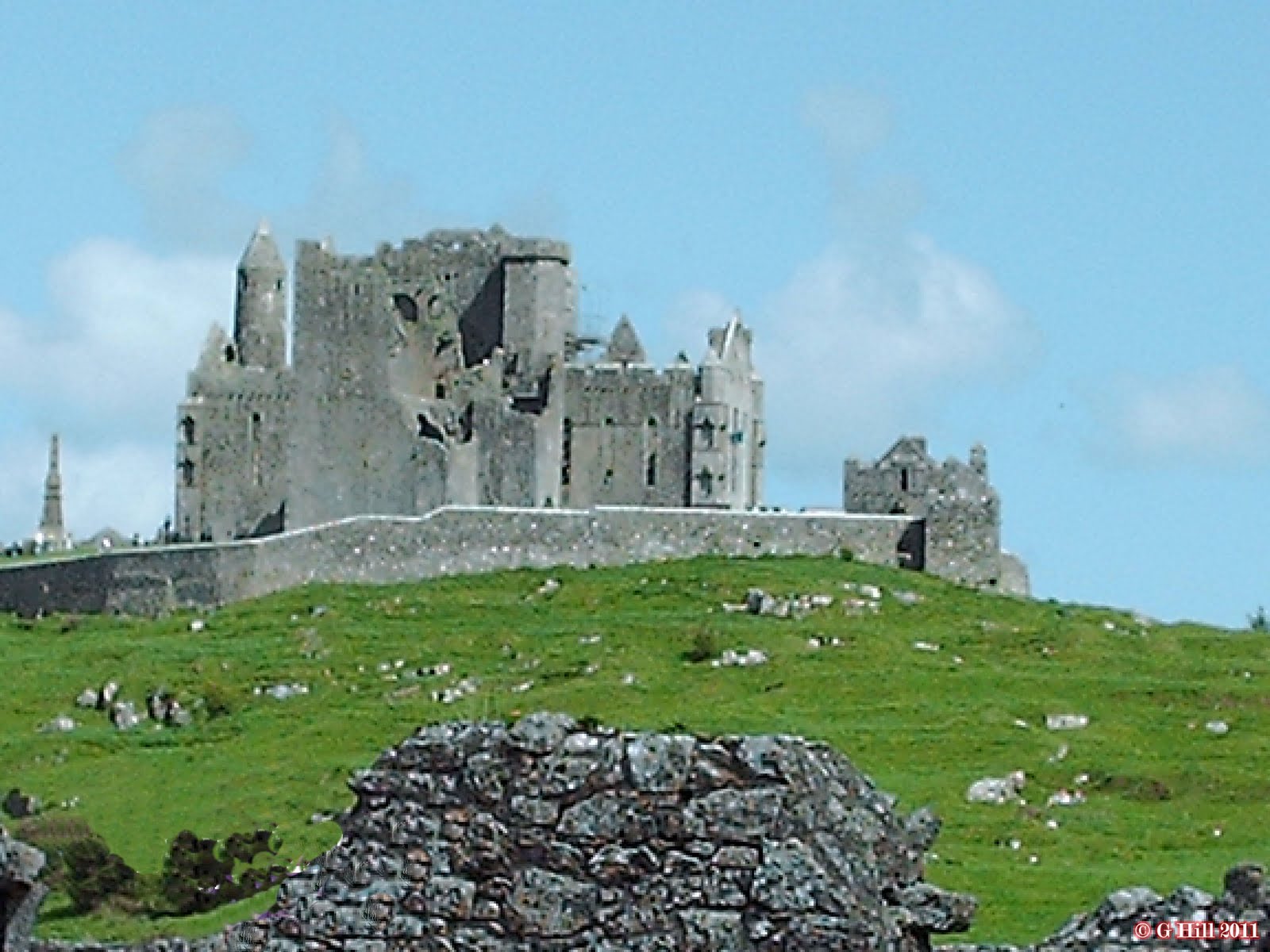
If you are travelling from Dublin to see the Rock of Cashel you will find yourself coming round a bend in the road and all at once this spectacular ruin perched upon a limestone outcrop comes into view. If it is a bright day it will be silhouetted against the sky like some vision of Castle Dracula! The Rock, also known as St Patrick's Rock, is a holy site dating back to the time of St Patrick. The ruins consist of 12th century Chapel and High Cross and a 90 feet tall Round Tower. Surrounding these are a 13th century Gothic Cathedral and a 15th century Castle. Quite a collection in one spot! Cashel was the seat of the Kings of Munster prior to the Norman invasion. In 1647 it was ransacked by English parliamentarian troops and all within were slaughtered. 1749 saw the roof being removed and the site fell into ruin.
The Rock of Cashel is a must see and although there is an admission charge it is worth your time. We have visited about 3 times over the years and it never fails to enthrall. There is so much history here.
To get to The Rock take the M7 from Dublin then join the M8 and exit when you reach Junction 17. Take the R639 into Cashel. Once into the town you will see a sharp V-shaped turn right. Carry on down this Road and you will find a large car park on the right (€2). It is a short walk uphill to the entrance.