Saturday, 11 August 2012

Ballycowan Castle Co Offaly


                                          Above Image: The entrance stile


                               Below 2 Images: The Vaulted chambers beneath


The ruins of Ballycowan Castle with it's tall striking chimneys stand loftily on elevated ground overlooking the Grand Canal  a few miles west of Tullamore. The large fortified house was constructed in 1589 by Thomas Morres on the site of an earlier Castle belonging to the O'Molloys which was gutted by fire in 1557.
The new Castle was extended upon by Jasper Herbert in 1626 and the Herbert coat of arms can still be seen on one of the gable walls.
The Castle's South West walls were destroyed during an attack by Cromwellian forces and the lands were handed over to the English crown and subsequently granted to the Earl of Mountrath in 1666.
The four storey Castle contains vaulted ceilings on it's ground floor rooms and mullioned windows are very much in evidence. The defences of the Castle included a machiolation above the entrance and a bartizan at its North east corner.
The Castle is accessible at two points. The section with the entrance door and evidence of a Bawn lies within a farmyard. There doesn't deem to be much Human activity there but it would be wise to seek permission first.
The other section lies in an open field beside the Tullamore River which runs under the canal. You need to walk down the old Canal towpath as far as the stone bridge. Just before this bridge there is a slope leading down to some scrub on the right. Here almost hidden out of view is a fence with rudimentary stile which is not too difficult to cross. There is a sign which states reserved for gun club (as was with Srah Castle, not too distant) but nothing forbidding entry. Once in the field you will find it overgrown and stony underfoot in places. Some of these grass covered rocks are more likely to be rubble from the Castle. There also appears to be a Bull in the field but he was at a reasonable distance on our visit and seemed indifferent to our incursion.
 A slightly steep climb to the ruins in which care is recommended as the the long grass can be deceptive of what lies beneath, gives you access to the sunken floor of the Castle. Entry is through a gap in the wall. Within are two chambers with their barrel vaulted ceilings. There is another gap in the wall here leading to a third chamber but it has been somewhat shored up with rubble probably for safety reasons.
It's a great place to climb around and has a really creepy atmosphere within the vaulted rooms. There are probably more rooms to discover by way of the entrance on private land but that's for a future visit.
To find the ruins, take the R443 out of Tullamore towards Rahan. About a mile or so on you will reach a roundabout. Turn Left. Drive for approx. 2 miles until you reach  a left hand turn with a bungalow at it's corner  just before the main road takes a sharp bend right. Turn left by the bungalow and drive until you reach the bridge crossing the Canal. You can park your car on the immediate part of the towpath but be careful not to obstruct any gates.

Sunday, 29 July 2012

Castledermot Abbey Co Kildare


                             Above Image: The great window arch stands proudly.


Castledermot Abbey was founded in 1302 by Thomas Lord Offaly along with benefactors to the
Franciscan order, the Hoydes. The impressive Abbey was famously ransacked in 1317 by Robert the
Bruce but continued functioning until it was suppressed by Henry VIII in 1541.
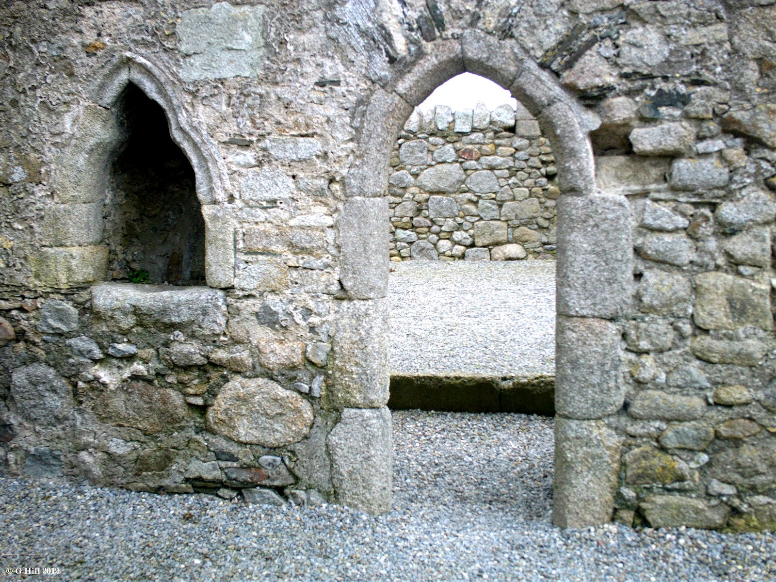
Although only the shell of the Abbey remains today it still retains a very interesting aspect. Attached to the South wall is a square Tower locally called the "Abbey Castle" which dates from around the 15th century and may have been used as a residence for the order. A number of fine arches and lancet windows survive in very good condition and they give evidence to what may have been quite an opulent structure in it's time. The Abbey was partially destroyed by Cromwellian forces in the 1600's and subsequently fell into ruin.
The initial view of the Abbey is of the East wall on Abbey street in the town. It stands literally a few feet from the roadside and looks promising but a little spoiled by the modern buildings adjacent. The interior however that lies beyond the small padlocked gate is far more interesting.
Finding the gate locked to protect the Abbey from damage is at first disappointing, but a key is held in the house to the left hand side of the entrance by a friendly caretaker. He gave us the key and told us to just drop it back in the letterbox of his door when we were done.
Once you enter the gate you are literally transported to another age. The stonework is superb in places and the arches glide majestically over the skyline. The absence of litter within, the silence and the generally good upkeep makes it almost unbelievable that  a modern street lies just on the other side of the gate.
One gripe though, access to the "Castle" is not possible but a walk around these walls is interesting enough to warrant a visit. We kept the gate locked during our time there so that we could have a good look around undisturbed, but it didn't seem as if there were any other prospective visitors anyway that day.
To find Castledermot Abbey, take the M9 Dublin to Waterford road and exit for the R747. At the junction of this road with the N9, turn right and drive for approx. 5 miles. This will lead you directly into the main street of Castledermot. This main street becomes Abbey street at the far end of the town. Look for the Abbey on your right. Parking is easy enough around the general area of the Abbey..

Sunday, 15 July 2012

Srah Castle Co Offaly

                    Above Image: You can step over the barbed wire left of the gate in
                                           the foreground


                    Above Image: The entrance with Bartizan and Machicolation above.


                          Above Image: The upper storeys showing mural corridors


                              Above 2 Images: The remains of the spiral staircase


Srah Castle was constructed in 1588 by John Briscoe, an Elizabethan Officer from Cumberland. It was built as a four storey Tower House stretching 65 feet in height. The ruins of an adjoining 17th century residence stand on the North West corner of the Castle. Features of this heavily defencive Castle include gun loops, bartizans and a machicolation above the now ruined entrance door on the West wall. The machiolation was a projecting gallery with floor openings through which rocks and boiling liquids could be directed at attackers below. Though well designed with defence in mind the Castle still suffered extreme damage during the Cromwellian campaigns around 1650.
Today the Castle is approached by way of a former towpath of the late 18th century Grand Canal which stretches from Dublin all the way to the Shannon River in the West.
We have wanted to visit this ruin for quite a while and an opportunity this summer allowed us to do so.
Walking along the towpath at first there appears to be no sign of the Castle as it is cloaked by a large clump of trees at the field perimeter, but as soon as you reach them then the Castle comes into view looming above them.
The ruins stand in a slightly boggy meadow and you need to carefully step over a low barbed wire fence to gain entry. There is a sign stating "Reserved for Gun Club" but there is no prohibitive message so basically it is fair game. Later we would discover that entry was all too easy as on entering the ruins we were dismayed to find the ground littered with broken bottles and cans which is no doubt nothing to do with the gun club and more assuredly some local wastrels. This unfortunate circumstance may also be the reason that part of the spiral stairs has been removed to avoid any misadventures. The top part of the stairs can be seen above the third storey and it is a pity that you cant access what looks to be exposed doorways leading to mural corridors which would have been interesting to explore.
On the exterior North Eastern facing walls the bartizan is missing leaving a gaping maw in the Castle wall.
Large fissures are also evident on at least two walls stretching nearly the full height.
This is a Castle badly in need of some preservation. It is such a dramatic ruin and would certainly garner tourism especially with it's proximity to the canal and Tullamore Town.
To find Srah Castle take the M7 motorway from Dublin to Limerick and exit at Junction 17 onto the N80.
Follow this road through Mountmellick and Killeigh until you reach Tullamore. Take the route into the Town centre and turn left onto Patrick St. At the top of this street swing right and then left onto Kilbride Street.
Just over the bridge on the canal there is an immediate left turn onto Rahan Road. About 500 feet down this road you will see the towpath on your left. You can park here or back on Kilbride street (Disc Parking) if you wish. Walk along the towpath until you have passed under a road bridge and a rail bridge. The castle is on your right a short stroll later.

Sunday, 8 July 2012

Old Kilcullen Round Tower & Church Co Kildare


                               Above Image: A Shaft of one of the High Crosses.

                                    Above Image: The entrance stile in the wall

                                    Above Image: The remains of the Church

                                           Above Image: The Tower doorway

                               Above Image: Another view of the Church remains


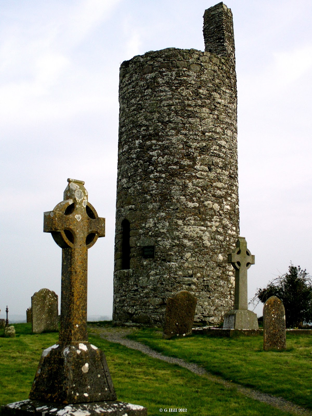
Standing on elevated ground above the Kildare countryside and commanding a wide view are the Round Tower and Church remains of Old Kilcullen.
A monastery was founded here by St. Patrick in the 5th century and he placed it under the care of St. Mac Tail who he had himself ordained. Mac Tail died in 548 succumbing to the yellow plague that swept through Ireland at that time. He is said to be depicted on the panel of one of the High Crosses in the grounds.
The Annals of the Four Masters record that the Monastery was ransacked by the Danes in 936AD and again in 944AD. All that remains today on this site are the incomplete Round Tower (circa 11th Century) and the scant walls of the old Church.
The Tower stands at approximately 27 feet with a doorway about 6 feet from the ground. This Tower is believed to have been used as a Bell-Tower and a depository for valuables. The Tower was depicted in a drawing from 1792 showing much of the west side intact and part of the cornice on top, but it was already in a ruinous state and was reduced to it's present size when damaged during a battle on this hill in the 1798 rebellion when over 300 Irish rebels entrenched themselves in the graveyard.
The graveyard is still in use today and easily accessed (if gate is locked) by a sturdy stile in the wall just to the right of the gate. The lofty views from this site especially on a clear day are breathtaking. The remains of the Round Tower bear a plaque recording its damage during the rebellion but it still stands proudly over what is now a much decimated site. The Church ruins are reduced to low walls which just about give an indication of its original size and there are some interesting High Crosses adjacent. There is a great sense of history here and is certainly worth your time if in the area.
To find Old Kilcullen ruins take the M7 from Dublin and exit at Junction 11 onto the M9. Drive for about 4 miles until you reach the exit for the R448. Turn right at the top of the exit ramp and drive for about a mile, you will pass a junction with the N9 on your left . Continue on for another mile or so until you reach a crossroads. Turn Left and drive to the end of this road. You will see the Round Tower ahead of you. There is reasonable space to park outside and a short walk up the hill by pathway will bring you to the site. Be careful to close the narrow metal gate by the roadside as there are sheep in the adjacent field who frequently wander down to it and in our experience tried to get out onto the road.


SECOND VISIT JUNE 2018


                                               Above Image: Ancient cross shaft

                                        Above Image: Cross base and partial shaft

                                  Above Image & Below Image: Church foundations


                      Above Image & Below Image: Detail on the decorative cross shaft


Another recent return visit and I'm glad to say that nothing has changed at this site, no deterioration whatsoever. It is still maintained well and we got a better day weather wise to get some additional shots of the wonderful cross shafts here. The smallest and most worn of a base and partial shaft has
even developed a bullaun on top where it has broken away. After rain I would imagine this would resemble a rudimentary font. I would have no hesitation on returning here again.

Friday, 29 June 2012

The Giant's Grave Co Dublin


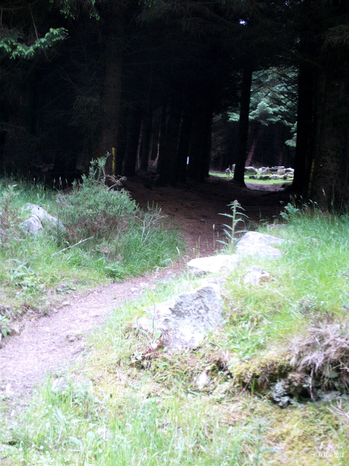
                                            Above Image: The Forest Trail
                                   Below Image: The Track leading to the Site


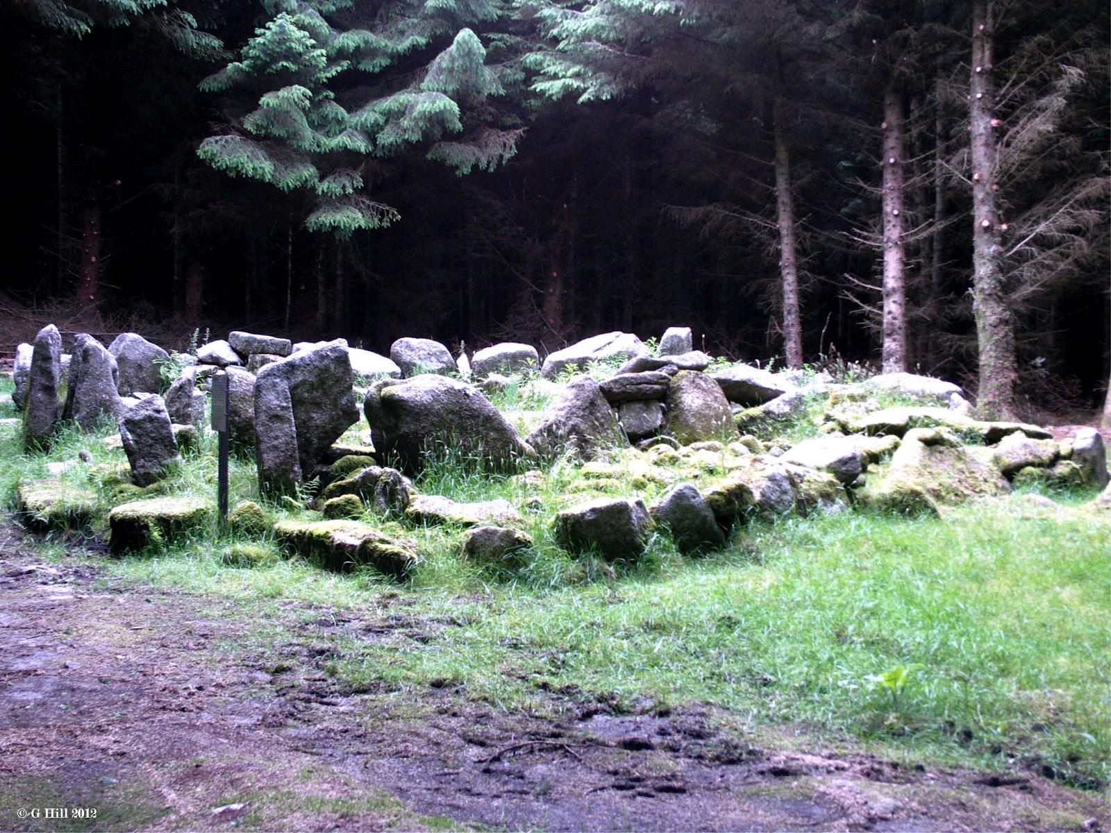
                         Above Image: Cairn Stones mixed with Standing Stones


                                       Above Image: The exposed chamber


This Neolithic Wedge Tomb is really an incredible sight. Photos just dont give it justice. It needs to be seen in person. It is a rectangular chamber positioned into a wedge shape which had a Cairn constructed upon it. Experts have dated it to the Bronze Age circa 1700BC. It was excavated in 1945 and within they discovered some cremated remains, flint implements and some pottery. The Cairn at one time stood almost two metres high but has now fallen into ruin with the roof of the chamber now missing. Some of the Cairn stones are still scattered among the surrounding standing stones.
The Tomb is known locally as "The Giant's Grave" and is situated in a circular clearing in a pine forest on the lower East slopes of Two rock Mountain. This treasure is hidden away but is so easily accessible on foot that it is incredible that it is not visited more often. Maybe in some ways that is a good thing as it's almost secret spot is devoid of any litter and such that plagues some of the other historical sites that we have visited.
The site is reached by way of a walking trail from a gate on Ballyedmonduff  Road. A sign posted by the gate thanks two local landowners for their co-operation in allowing access across their land.
A short walk across a sheep filled field leads you to a boundary fence with a sturdy ladder type metal stile that is easy to climb and drops you right on the forest trail.
Once over the stile we followed the trail to the left. The trail bypasses a Golf course on it's left and then it bends sharply to the right. It took less than ten minutes to reach this point. Just after the bend and a few yards later on to your right hand side is a small track leading off the trail into the forest. Even from this position we could see the Tomb between the tall trees. The track led us across a narrow gurgling stream with a couple of stepping stones to aid progress and then a few yards later we entered the clearing. On first view this ancient Tomb is truly an amazing sight. The trees had been felled around the perimeter making the glade an almost perfect circle.
Although quite ruinous now the Tomb still looks impressive. We have come across several Cairns & Tombs in the past but this is by far the largest and most interesting. Some of ths standing stones still remain on the North And West sides and it also surprising to see an information board posted nearby.
I have to say we spent a good deal of time here. There was a distinct atmosphere about the place. A real sense of history. To be honest we left the site a little awe-struck.
As with most of our Castle ruin trips, we were the only ones present when we made the visit on a fine June evening. In fact we met only two other people who were out running on the forest trail. We will definitely return to this site in the future.
The easiest route to find the Tomb is as follows: From Kilternan on the R117 towards Enniskerry take a right hand turn at the blue wooden Church onto Ballybetagh Road. Follow this Road around two sharp left bends and about 600 metres along you will reach a fork in the road. Take the right hand fork signposted for Glencullen. After you have passed Johnnie Foxes Pub you will come to a crossroads. Turn right. Drive for about 1.5KM passing Glencullen Golf Course on your left. This is Ballyedmonduff Road. Look out on your left for a Bungalow with a cylindrical bay window and a wire fence posted atop a stone wall. Just a little along this fence you will find a stepped back gate with a track leading up to the forest. There is a small wooden pedestrian gate to the left of the main gate for safe access. We parked to the side of the road just past the gate where it was slightly wider but in general it seems there are few other spots to park.