A guide to the best and sometimes off the beaten track historical ruins around Ireland and how to get there.
Sunday, 8 April 2012
Cullahill Castle Co Laois
Above Image: A Narrow passage around the base
Above Image: A rocky ascent into the interior
Above Image: An entrance to the courtyard
Above Image: One of the interior passages
Above Image: Steps leading to the courtyard
This impressive ruin stands up to 90 feet high and is built on solid rock. It was a formidable keep constructed in approx.1425 by Finghin MacGillapatrick. It stands five storeys high and is built of limestone.The castle saw many attacks through its relatively short life by it's owners enemies from Kilkenny, who supported by the Crown sought to destroy this massive keep. Eventually it would fall to the forces of Cromwell in the mid 17th century who totally bombarded it with cannon fire leaving it ruined and uninhabitable by 1657.
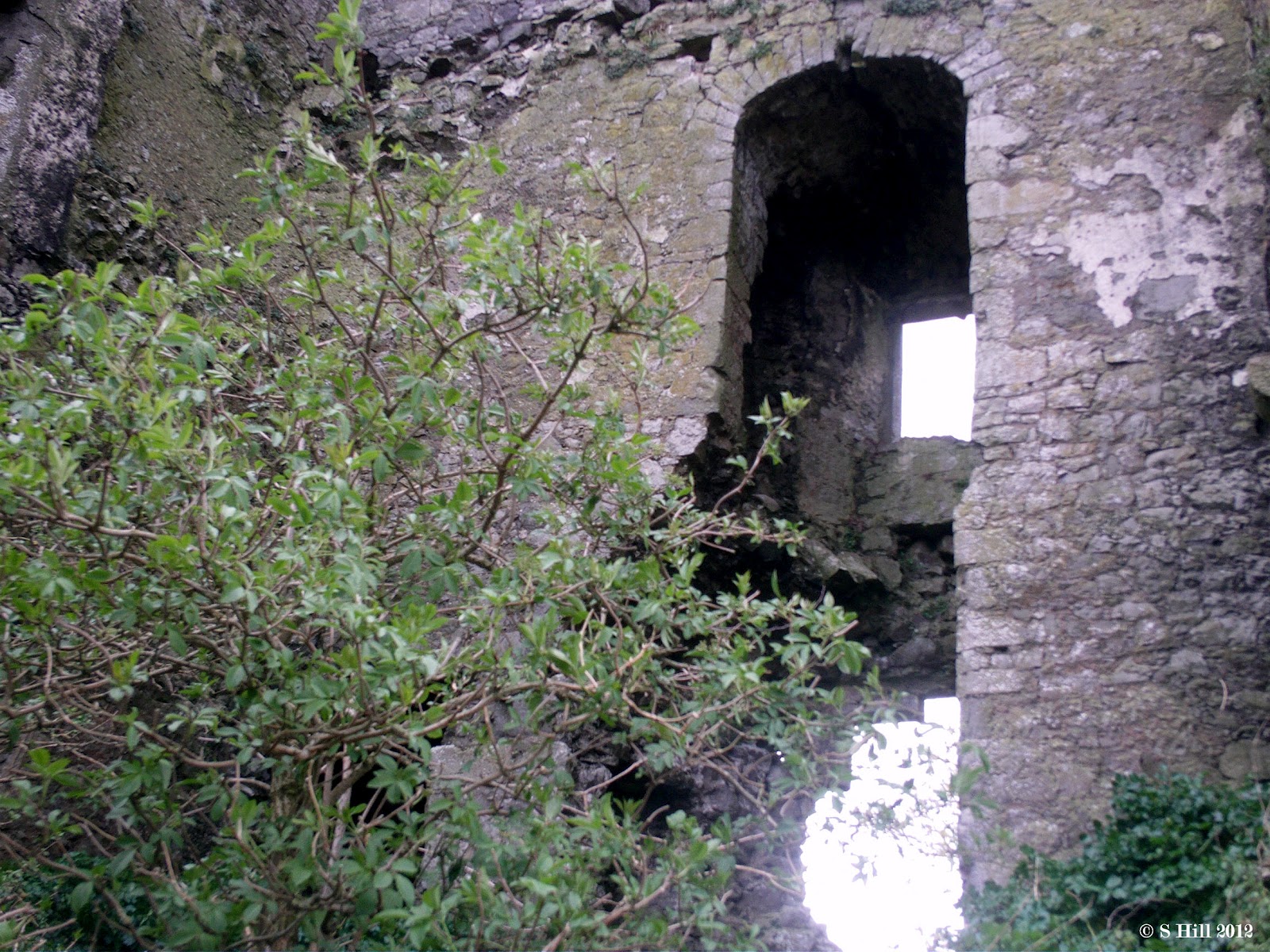
The Castle stands at the southwestern end of a large circular bawn and it's sheer height must have given it wide strategic views of the surrounding countryside. The cannons took out the north facing wall and portions of the east and south walls, otherwise the remaining walls stand to their full height and are home now to flocks of birds which circle the tower breaking the silence. The exposed interiors of the castle highlight many arches and fireplaces. The very thick walls carried mural passageways and led to many chambers.
Accessing this Castle is easy. It sits on the fork of two minor roads just off the main road in Cullahill Village. When we arrived it was quiet and only a couple of people sat at a picnic table just outside the bawn wall. This route is part of a heritage trail so many people pass this way. But how many try to access the ruins? We looked for some form of entrance and found that a yard adjacent to a house had a small irregular entrance into the bawn. This was private land so we just took a quick look but didn't immediately find any entrance to the Tower itself. A cat strolled by nonchalantly looking sideways at us but it was when a dog appeared glaring at us we thought it better to slip away.
Back outside we climbed up the rather tricky area that led up to the exposed interior. It was overgrown with thickets and was quite steep and rocky underfoot, but we managed to ascend to one of the openings in the wall. A couple of locals passed by with dogs and seemed bemused at our antics, advising us that the ruin was dilapidated and might be dangerous. We acknowledged their concern and carried on. Faint heart never won fair lady as they say.
Within the ruins we followed a passageway looking for some way to ascend further. Eventually we found a stairs which led both down and up. The stairs actually led down to part of the courtyard! It might have been a better idea to ask the owners of the house if we could enter and they might have mentioned the stairs. On the other hand when we reached the top of the stairs it ended in a sheer drop without any safety rail so they might not have encouraged the climb for safety reasons. All in all it was very satisfying to have made the climb although it was trickier getting back down to the ground as we decided to go back the way we came. Our canine friend was still probably patrolling the courtyard. This ruin is a must for a visit. About a hundred yards down the road is a small ruined chapel that was associated with the castle's owners and is also worth your time.
To find Cullahill Castle, take the M7 Dublin to Limerick motorway and exit at Junction 17. Follow the N77 through Abbeyleix and when you reach Durrow take a right turn onto the R639. Drive for approx.5 miles and you will spot the impressive ruin in the distance to your left. As you enter Cullahill Village there is a left hand turn just opposite the Sportsman's Inn Pub. You will find the Castle a few yards up this road. Roadside parking is possible near the ruins.
Sunday, 1 April 2012
The Black Abbey Co Kildare
Above & Below Images: Inside the Tower
This sturdy ruin was built in the early 13th century as a preceptory for the Knights of St John of Jerusalem. The name derives from the colour of the habits worn by this order and it appears this site at Tully was of some importance in it's early years. Several chapters of the order were held here and patronage came from the local lords. The turmoil of the reformation however meant that the site was eventually confiscated and suppressed by the Crown of England in 1538. The lands passed through many owners thereafter and time took it's toll on the great building leaving it in ruin like so many others of it's kind.
Today it is situated within the grounds of the National Stud of Ireland. Strangely enough there is no access from the Stud itself, a hedgerow borders the grounds, but being that an old cemetery is adjacent there is access from the Tully road that borders it on the South-west side. A low wooden fence marks the perimeter of the National Stud grounds and one would think that this was private property with no access. In fact there is a small wooden gate which has a chain latch. It looks locked but it unhooks easily enough. It bears a sign saying "Please Close Gate". So we did. A wall surrounds the site of the ruins but there is again a gate with a chain latch and additionally a stone stile for access. Nobody seemed to mind us clambering about. Over the hedgerows National stud staff were going about their business and we expected to be approached and maybe told to leave.But it never happened.
The ruin itself consists mostly of a tall square Tower and some adjoining walls. You can step inside the Tower through an open entrance on the South facing side and there is an additional small arched gateway on the north facing side. This leads only to a grave site. Within the Tower itself, the light streams in from the semicircular window and shows off the very fine construction of the walls.Unfortunately there doesn't appear to be any way of climbing the Tower. I would imagine there would be some view from up there. An ancient graveyard sits beside the Tower and there are some more recent graves dotted around the area.
To find and access the Black Abbey, take the M7 Dublin to Limerick Road and exit at Junction 13. Take the left hand turn at the roundabout onto the R415. Drive for approx. 600 metres until you reach a small crossroads. Turn left following the sign for The Japanese Gardens and drive to the end of this road until you reach a T- Junction. The small wooden access gate is directly in front of you and to it's right is a small area where you can park off the road. Follow the requests to close gates behind you and you should have no trouble entering.
Friday, 23 March 2012
Killelan Abbey Co Kildare
Above Image: Some of the impressive stonework
Above Image: Inside the Tower
Above Image: The spiral stairs
Above & Below Images: Up on the Roof
This interesting looking ruin is located in the Killelan area close to the Village of Moone in Co Kildare. Moone is of course famous for it's High cross, but there are also a number of other historical sites in the area and this is one of them.
Information regarding the ruin is scarce, but it is thought to be the remains of a monastery founded by the Knights of St John of Jerusalem early in the 13th Century. The large square tower has a barrel vaulted ceiling within and there are small sections of what was once the foundations of the Nave. The circular tower at it's northwest corner is believed to have been added in the 1400's. This tower fortifies the building somewhat and has a spiral staircase which leads to the roof. There doesn't appear to be much information about the later years of the monastery but it is quite possible that it met with a turbulent end as many Abbeys did during the Cromwellian invasion.
Finding this ruin,although out in the countryside, was simple enough. The road that leads southward out of Moone brings you right to the site. You will easily spot it on your right hand side as you approach.
Access to the graveyard that surrounds the ruins is by a reasonably sized pedestrian gap in the boundary wall just to the left of a small closed gate.Within the boundary there is a slight incline up to the ruin but take note that the ground is quite uneven with large clumps of grass that can be deceiving, so be careful underfoot.
Standing within the tower you are protected by the barrel vaulted ceiling and you will notice some interesting stone masonry especially around the window. We heard that it was possible to ascent the round tower but there didn't seem to be a doorway. On closer inspection we spotted a small opening measuring around 3 x 2 feet at ground level. Apparently the ground within the Abbey is higher than that outside, so this opening is actually the top portion of the stairs doorway! To access the spiral stairs you will need to crawl in underneath the opening. The stairs leads to the roof and is only wide enough for one person at a time and the steps are badly worn in places. But we still managed to climb up. The rooftop is also uneven and covered in grass! The views however make the climb all the more worthwhile. The descent was to say at the least a bit scary but we managed to get out in one piece all the same.
The graveyard contains some decorative grave markers, some up to two centuries old and there are some even older gravestones.
On the day we visited we were alone at the ruins. On a blustery day this might be quite a windswept area so a calmer and brighter day as it was for us would be a better option to make a visit.
To find Killelan Abbey, take the M9 heading south and exit for the R747 to Castledermot. At the top of this road is a T-junction. Take the right hand turn onto the N9 and drive through Timolin and Moone which are very close together. The road veers a sharp left as you exit Moone. Follow this road for approx.1 mile and you will spot Killelan Abbey on your right. You will reach a staggered crossroads at which you turn right. Parking is possible at the boundary wall about 100 yards up this road.
Saturday, 17 March 2012
Old Downings Church Co Kildare
The ruins of the Church are surrounded by a circular wall in the pattern of earlier Christian burial sites and indeed part of one of the original ramparts still remains today. The Church was probably built by the Knights Hospitallers around Norman times and the area it occupies measures approx. 42 feet by 16 feet.It appears to have been in ruins by 1837 according to Samuel Lewis' directory.
It is not difficult to find Downings although it is not signposted. We found it's exact location by scouring the road to Allenwood on Google Maps (Satellite) finally spotting what looked to be a graveyard. When we arrived on site we found a metal gate that appeared to lead to the ruins but had Co. Council warnings of "No Dumping" and was well and truly locked. A bit disappointed and about to leave, we just happened to spot a smaller gate about 20 feet to the right in a hedgerow and behold it led into the field in which the walls of the graveyard were visible. It looked to be private land but there were no prohibitive signs and the gate wad just tied with some rope.We followed the country code and after we had entered closed the gate behind us.
It had been raining a little earlier in the morning and so this crossing was decidedly swampy in places, but we eventually made it to the outer wall. There appears to be some restoration work in progress by a local concerned group and they have requested on the banners draped on the walls not to disturb their handiwork.
"Take nothing but photos and leave nothing but footprints" as the old saying goes!
A small pin is required to be removed to open the gate in the wall and once done then you are in.There is not a great deal to see really, the remains are scant but it is interesting to see the layout of an ancient burial site. The east facing gable is mostly standing with a circular hole where a window one was. A large tree looms over this end giving quite a dramatic effect. The gable is ivy covered and there are sections of the Church walls still in evidence to give you an idea of it's original size.Centuries of wear and tear has taken it's toll but as mentioned, local effort may slow down the process a bit. It's always a shame when an important historical structure ends up covered in vegetation and perhaps disappearing from view. Annaghaskin Church in the Enniskerry area is a case in point. We are still trying to locate it and have so far narrowed it down to a clump of trees and overgrowth in a field in the Monastery area of Enniskerry.
If in the area of Prosperous check out Downings ruins, a very old and strange place indeed.
To find the ruins of Downings, take the N4 from Dublin and exit at junction 5 for Celbridge. Continue on the R403 through Celbridge, Clane and Prosperous. About 1.5km outside of Prosperous watch out for a wide gate with hills of gravel on your left. You can park here. The gate for the entrance to the field is to the right of the larger gate opposite the gravel pit.
Tuesday, 13 March 2012
St. Crispin's Cell Co Wicklow
Above Image: Tarrant's Farmhouse as seen from the Chapel
Above Image:The Chapel interior complete with graffiti
Above Image: The rail crossing to the cliffs
Above Image: The view from the cliffs
St Crispin is the patron saint of shoemakers who was popularised by the mention of St Crispin's day in Shakespeare's Henry V. This led to his name being attached to many buildings of the time and it appears that this may be one of them.
The small Chapel was constructed circa 1530AD and appears to have been designed as a Chapel for the nearby Rathdown Castle which has now completely disappeared. It is thought that quite a bit of the stonework of the Castle was scavenged by one Captain Tarrant, a man who had caused quite a bit of local destruction in his time. He used these stones to build part of his farmhouse, the ruins of which now stand adjacent to the Chapel in the same field..It is thought that Rathdown Castle was in ruins by the 1600's and that the Chapel would have no doubt followed suit thereafter. The Chapel ruins are now protected by the state and were given a bit of restoration work recently by enterprising locals.
We thought that access to this field might not be easy but in fact it was quite the opposite. On a small suburban road with only a few houses there is an access gate (locked) with a gap to it's right hand side for pedestrians. Directly inside the gate a rudimentary pathway leads you around the ruins of Tarrant's farmhouse which is completely bricked up. Strange to think that some of the stonework here once supported a fine fortress.
A short walk across the field will bring you to the little Chapel ruin which stands proudly with a backdrop of the Irish sea. The railway line running along the field's eastern perimeter provides the only disturbance in this quiet area as trains occasionally rush by.
The Chapel has a fine rounded doorway which has been barred to protect it from further antisocial behaviour which resulted in graffiti being daubed over the interior. As you walk around the Chapel on the outside you will notice how it seems to be positioned on a hummock to give it more prominence. Apart from the missing roof, the gables and walls appear to be in good shape. It is well worth a visit if you are in the area. As an aside, on the access road you will find a level crossing over the railway line where you can cross (carefully!) and take a really nice cliff walk with fine views of Greystones Harbour and the coast. We kept our eyes open on this route for any evidence of the once fine Castle but failed to find even a trace.
To find St. Crispin's Cell take the junction 5 exit for Bray from the M11 Dublin to Wexford Road. Turn right at the roundabout onto the R761. Continue on through Bray main Street and take the left hand fork at the old town hall onto the R767 (Vevay Road). Drive for approx 4km until you see Bray Golf Club on your left. About 1km further look out for a left turn with a sign for "The Grove".About half way down this road on your right you will see the access gate for the Chapel. Do not park at this gate but a little beforehand on the wider part of the road.
Tuesday, 6 March 2012
Clane Abbey Co Kildare
Above Image: The Ruins with their more modern background
Above Image: Restoration work still in progress
The original Clane abbey dated back to the 5th century and was founded by St Ailbhe who was then Bishop of Ferns. The Abbey for the next few centuries concentrated on missionary work, but Viking incursions and the eventual Norman invasion saw an end to the native involvement. Norman clergy would replace the old.
In 1258 Gerald Fitzmaurice Fitzgerald a patron of the Franciscan order constructed a new Abbey upon the old incorporating some of the original foundations. The ruins in evidence today are of this later Abbey and they are situated on the Abbeylands area of Clane.The Abbey remained important for several hundred years and was host to the general monastic assembly in 1345. By the end of the 14th century the Abbey was in disrepair but received some succour due to local effort and new parts were added. The Abbey remained in use through difficult times but was eventually suppressed by Henry VIII's reformation and by 1540 had been dismantled and left to ruin. Recently through more local effort it has undergone some restoration work and cleaning up. It is now in the care of the local authority.
The ruins are accessible from the town by a set of stone steps in the form of a stile in the wall on the end of the main street just before the junction with the Clane relief road. There is also a narrow entrance to a park to the left of this where you can get another view. Once over the stile a short lane way leads you to the grounds which are currently used as a cemetery. The remaining walls of the Abbey stand parallel to each other giving an odd look to the ruins. You can walk in around the walls but due to some unfortunate town planning, a modern hotel sits behind diminishing the impact of the view. The walls have some very interesting patterns both architecturally and by the vegetation impacted upon them
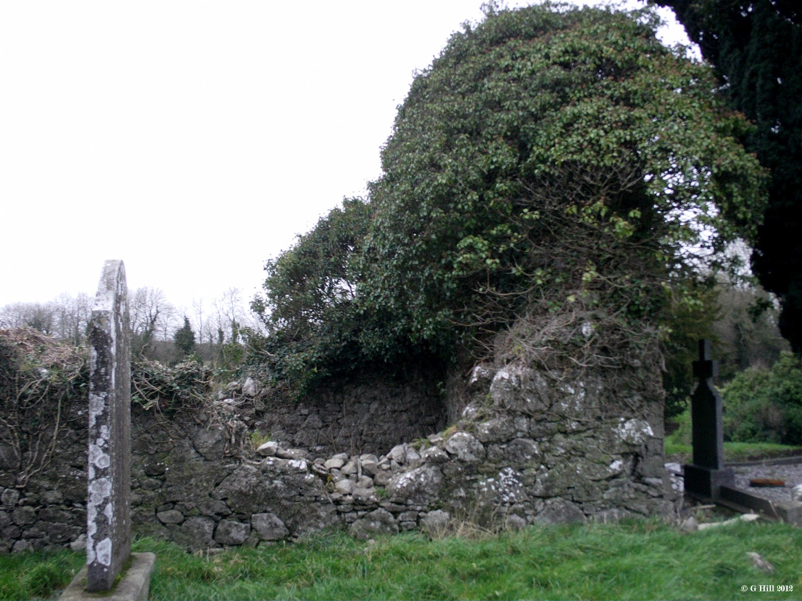
Although there is not a great deal to see, there is still a great sense of history and atmosphere which would have been far greater accentuated had the ruins been in a more rural setting rather than surrounded by modern development. Nonetheless this is an important site which is thankfully being cared for.
To find the ruins, take the M4 Dublin to Galway road and exit at Junction 3 for Maynooth. Turn off the roundabout onto the R406 Straffan road and drive for approx. 5km until you reach a crossroads with the R403 at Barberstown. Turn right and drive for about 6km to the village of Clane. The entrance to the Abbey is on your left at the bottom of the main street just before the roundabout adjoining the Clane relief road
Above Image: Restoration work still in progress
The original Clane abbey dated back to the 5th century and was founded by St Ailbhe who was then Bishop of Ferns. The Abbey for the next few centuries concentrated on missionary work, but Viking incursions and the eventual Norman invasion saw an end to the native involvement. Norman clergy would replace the old.
In 1258 Gerald Fitzmaurice Fitzgerald a patron of the Franciscan order constructed a new Abbey upon the old incorporating some of the original foundations. The ruins in evidence today are of this later Abbey and they are situated on the Abbeylands area of Clane.The Abbey remained important for several hundred years and was host to the general monastic assembly in 1345. By the end of the 14th century the Abbey was in disrepair but received some succour due to local effort and new parts were added. The Abbey remained in use through difficult times but was eventually suppressed by Henry VIII's reformation and by 1540 had been dismantled and left to ruin. Recently through more local effort it has undergone some restoration work and cleaning up. It is now in the care of the local authority.
The ruins are accessible from the town by a set of stone steps in the form of a stile in the wall on the end of the main street just before the junction with the Clane relief road. There is also a narrow entrance to a park to the left of this where you can get another view. Once over the stile a short lane way leads you to the grounds which are currently used as a cemetery. The remaining walls of the Abbey stand parallel to each other giving an odd look to the ruins. You can walk in around the walls but due to some unfortunate town planning, a modern hotel sits behind diminishing the impact of the view. The walls have some very interesting patterns both architecturally and by the vegetation impacted upon them
Although there is not a great deal to see, there is still a great sense of history and atmosphere which would have been far greater accentuated had the ruins been in a more rural setting rather than surrounded by modern development. Nonetheless this is an important site which is thankfully being cared for.
To find the ruins, take the M4 Dublin to Galway road and exit at Junction 3 for Maynooth. Turn off the roundabout onto the R406 Straffan road and drive for approx. 5km until you reach a crossroads with the R403 at Barberstown. Turn right and drive for about 6km to the village of Clane. The entrance to the Abbey is on your left at the bottom of the main street just before the roundabout adjoining the Clane relief road
Subscribe to:
Posts (Atom)


