Tuesday, 22 April 2025

Packhorse Bridge Milltown Co Dublin


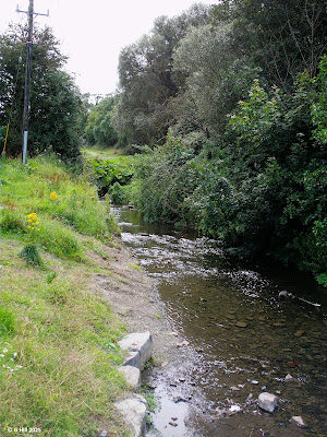
                                           Above Image: The pedestrian recess
                                                 

                                       Above Image: Twin arches South aspect.

                                 Above Image: Bridge access from Bankside Cottages


                                     Above Image: Access point from Milltown Rd.


                    X = Car park in village.   XX = Entrance to bridge   © Google Maps


This unassuming but yet locally historic little bridge was once a feature on the old Dublin to Wicklow road. It remained a bit forlorn for a number of years until a greenway project opened up this stretch of the Dodder river banks and made the bridge again accessible to all.
The bridge falls into the category of a "Packhorse Bridge" and indeed takes its name from it. These type of bridges can have a single or multiple arches or in this case it is twin-arched. Also, this bridge has a triangular extension to the centre support that allows a small rectangular area to jut outwards from the top of the Southern wall. This allowed pedestrians in times past to step back in off the centre of the bridge to allow horses to pass with their load. The walls on top across the bridge were also built a little lower to allow the saddle bags and packs on the horses to move freely across its span. This little step back is still there today and frequently I've seen people lying forth on their elbows to view the water below.
As to the date of the bridge's origin it's hard to define exactly, but there is a strong folklore tradition that it was built sometime around 1650 and that Cromwell crossed it during the initial part of the invasion of Ireland. If there is truth to this then the bridge may be a little older than thought as Cromwell reached Milltown in August of 1649. The bridge was originally built to replace a hazardous ford on the Dodder and so it is more likely troops and horses would have used a bridge to cross to engage in what was a bloody siege and battle with confederate forces. The church in Milltown was also ransacked before the invading forces moved on to the battle in Rathmines.
Packhorse bridge retains most of its original structure with perhaps some remedial work on the cobbling and such. The Bankside cottages run down a lane to it from the main road leading onto the modern road bridge and the small bridge can also be accessed on its other side from the Milltown road. The whole of the Dodder walk is a very bucolic experience but I have a fondness for this small bridge and its environs.
To find the bridge if visiting the area I would advise parking in Milltown village opposite the Wilde & Green café then walk back up towards the main road bridge. Continue straight on towards the Nine Arches Luas bridge (R820) and halfway between the two bridges is a small opening in the riverside wall. This leads directly onto Packhorse bridge (see map above).


Co-Ordinates: 53.30965, -6.24844


Tuesday, 25 March 2025

Ballinskelligs Abbey & Castle Co Kerry


                             Above Image: The approach laneway and entrance gate


                                                   Above Image: Chancel arch


                                      Above Image: Remnants stored within abbey


                                             Above Image: Western gable interior


                                  Above Image: Partly sunken doorway in North wall


                                       Above Image Castle as seen from the abbey


                                    Above Image: The castle's North West aspect


                               Above Image: Entrance to castle in South West wall


A recent trip to the Iveragh Peninsula in County Kerry revealed a few really interesting sites and among them was this impressive Augustinian abbey nestled on the coast with stunning views.
Ballinskelligs abbey was constructed in 1210AD in order to house the monks of Skellig Island who had abandoned their offshore habitat in favour of a more settled and secure monastery on the mainland. Numerous Viking attacks and increasingly poor weather conditions had sealed their island fate. The new mainland abbey was dedicated to St. Michael the Archangel.
Although it appears to have survived the dissolution of abbeys it was occupied only until 1568. 
During the 17th century it was given with its lands to Richard Harding of the nearby castle which stands on a promontory into the bay. It is believed the abbey's ruination began after the monks' departure and the chancel collapsed in the early 1840's leaving only the Nave and the Chancel arch and an ancillary building 
We visited on a fine summer's day and the views here were spectacular. The abbey is at the end of a long narrow lane adjacent to a very popular beach and although there was a throng of bathers nearby, the abbey did not seem to draw that much attention. It is also separated from beach access by fencing. 
The abbey appears to have originally been constructed around an ambulatory, or cloister, as it is also known. Some remnants remain of this.
A pointed bellcote arch is the only remains of the Chancel. 
Within the walls a metal table has been set up to display various remnants that had once littered the area of the abbey as it fell into ruin. Ruins of a residential tower, the Prior's house and the refectory are amongst the parts to be seen. 
This is a very tranquil spot overlooking the sea and a great place to relax a while away from the business of the world.
As mentioned the abbey came under the ownership of Ballinskelligs castle and following the Harding occupancy became the home of the Sigerson family. The castle was built as a MacCarthy Mor stronghold in the 16th century in order to protect the bay from attack and to tariff the trade vessels that sailed in. Subsequent Sigerson decendants were owners until the end of the 19th century but the castle finally succumbed to ruin thereafter and is now subject to coastal erosion. Works are in progress to save it from future collapse. However it is still accessible from the headland should you wish to venture out.
To find the ruins take the Ring of Kerry N70 route Northwards out of Waterville and drive approx. 12KM until you see a left hand turn signposted for  the R566 to Ballinskelligs. Turn onto the R566 and drive approx.10KM until you pass The Ballinskelligs Inn on your left. Approx 600m past the Inn you will come to a crossroads. The turn left takes you to the beach car park for access to the castle but to visit the abbey follow the sign straight on another 500m and take the un-signposted laneway on the left. You will see the abbey on the horizon. You can park up at the entrance gate. I would advise turning your car back facing the way you have come in case someone else parks there making turning difficult.


Castle co-ordinates  51.820828  -10.273095

Abbey Co-ordinates  51.815712  -10.272141

Monday, 20 January 2025

Mallow Castle Co Cork


                                             Above Image: The entrance gate


                                 Above Image: The interior showing North-East gable.


The dramatic ruin of Mallow Castle stands in the grounds of the current 19th century mansion on the South-East end of the town.
A former castle was built here by Bad King John in 1185AD and became a possession of the Earls of Desmond in 1282. It remained so for several centuries. Between 1569 and 1583 the castle became involved in the Geraldine wars and in the end was lost by the Desmonds as a result of the scorched earth policy of the English. Elizabeth I granted the castle to Sir Thomas Norreys along with all its land. The castle was in such a bad state that it was replaced by a new fortified mansion built by Norreys in 1585 in which he resided until his demise in 1599. It then passed to his daughter and her husband John Jephson.
The castle's fate became more turbulent when in 1642 it was laid siege to during the Confederate wars but it managed to survive the conflict.
Then in 1691 more trouble was laid at its door and it was badly burnt by fire during the Williamite war. As a result it was abandoned by the Jephsons and it subsequently fell into ruin. In 1928 it was given the status of a National Monument.
The ruins today are still quite extant. The house itself stands four storeys high with four towers standing another level higher still. The most complete is the North standing hexagonal tower. When we visited we only had partial access and at the moment it is being renovated and so only exterior views can be made until this work is completed. Nonetheless this is a very striking structure and well worth a visit.
Access is very easy through the main gate on Bridge Street. There is a small car park adjacent to the castle estate and a much larger one nearby on Park Road.
To find the ruin take the N20 roundabout exit for the N72 East towards Mallow Town Centre. Approx. 250m along this road turn right again following the N72. Drive till you reach a set of traffic lights and take the left turn onto Bridge Street. There is a car park around 30m along on your right. The castle entrance is another 30m along by foot. 


Co-ordinates  52.133951,  -8.639380