Wednesday, 13 July 2011

Kilteel Castle & Old Church Co Kildare


                               Above Image: Part of the old monastic site
                             Above Image: Monastic ruins with Castle in background
                           Above Image: The walled Church ruin & Graveyard


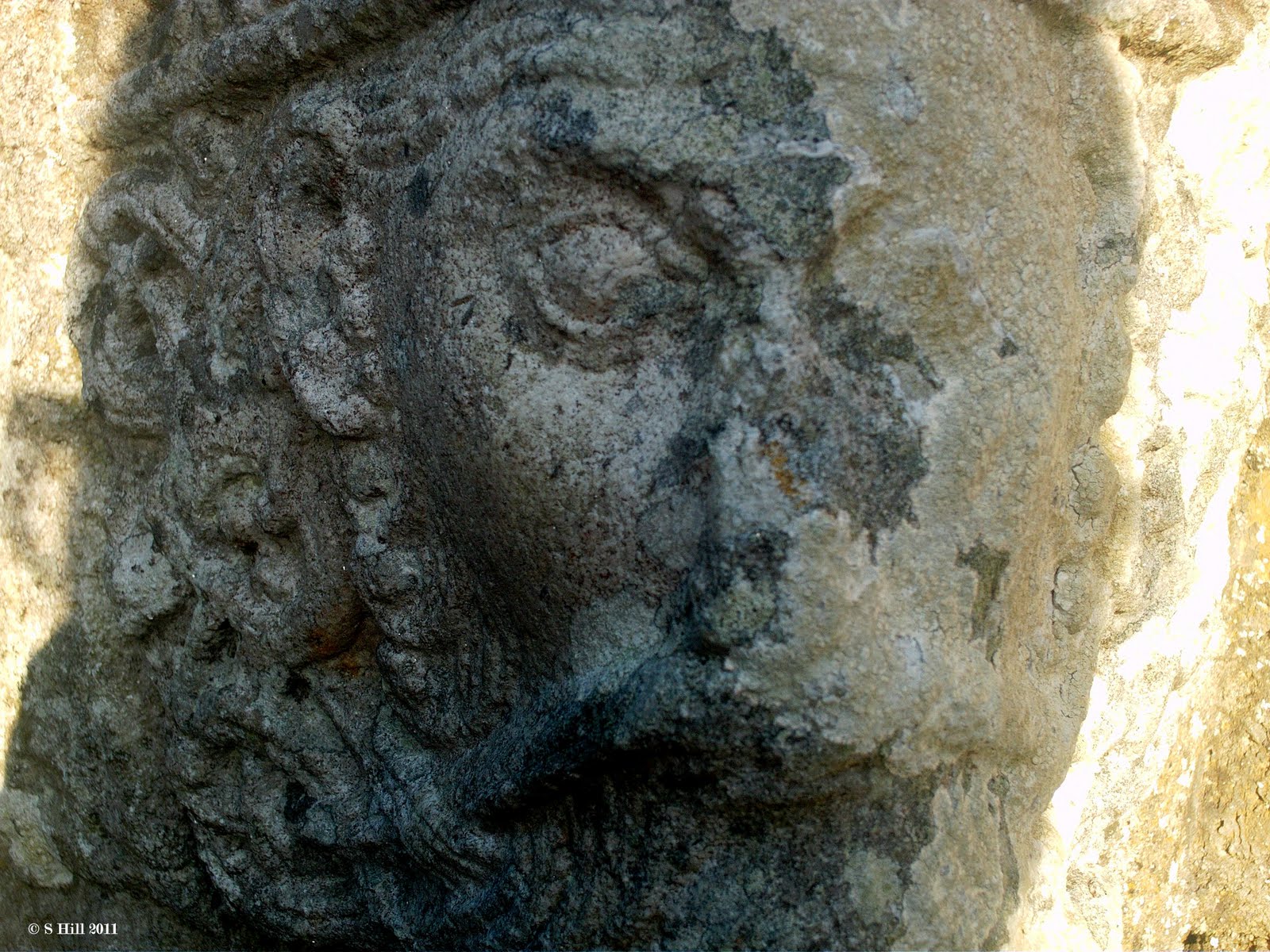
                               Above Image: One of the stone head carvings

The imposing ruin of Kilteel Castle stands on private ground near the small Village of Kilteel in Co Kildare. The Castle dates from the 15th century although a preceptory was built earlier on this site by Maurice Fitzgerald for the Knights Hospitallers of John of Jerusalem. The Castle has five storeys and a spiral staired extended Tower on it's right hand side. This Tower is still possible to climb.
The Castle lands changed hands many times during it's history, from the Earl of Tyrconnell in 1669 to the Fownes Family until 1838 and the Kennedy Family thereafter. The Castle was laid siege by cromwellian forces in the mid 1600's and subsequently began it's descent into ruin. In the fields adjacent are the ruins of a Monastic settlement, some parts dating back to the 8th century.
We approached the Castle on a Summer's evening and parked our car by the gate to the land on which it stands. There was a notice on the gate stating private property and no trespassing. We knocked on the door of the house beside the castle and a pleasant lad said it was no problem to have a look around and seemed pleased that We had bothered to ask.
There is a large archway in the Castle wall and within this there is a gated door with access to the Tower. The owner holds the key. Beyond the Tower We found a Farmyard with what looked like some ancient cottages now being utilised as storage. There was a resident Dog who eyed us from his kennel but never bothered us while We were within the grounds. The Tower and front wall are all that remain of the Castle but in the fields behind are a number of ruins from the former Monastic settlement that are well worth a look. The field is a bit spongy in places and you will need to cross a dried up River bed, so appropriate footwear is recommended. Here you will also discover a walled Graveyard with Church ruin that has a number of interesting stone carvings. The wall has a stone stile for access.
To find Kilteel Castle, take the N81 from Tallaght towards Blessington. After passing through Brittas you will see a sign for a left turn to Kilbride (Manor Kilbride). Just after this turn on the right is a narrow local road. Take this road and after about a mile or so the road forks. Take the right hand route and this will lead you to a T-Junction. You will see the Castle on your left. Turn left at the junction and you can park easily enough by the roadside. Please ask for permission to enter, as the Dog mentioned earlier has a different opinion of people trying to open the gate!.

Sunday, 10 July 2011

Old Palmerstown Church Co Dublin


                           Above Image: The view from the Church across the Liffey
                                                 Valley towards Chapelizod


Situated just off Mill Lane in Palmerstown Lower, this interesting old ruin lies deep in undergrowth and almost forgotten.
The Church was first recorded in annals in 1220 as belonging to the Prior of St John the Baptist without Newgate. The Church however certainly dates back at least 200 years more and is a good example of its type, a simple Nave and Chancel. It's original name was Stacgory.
The roof long disappeared has left the sturdy walls and Bell Tower intact but little more. It has some interesting stonework on it's arches and it is surrounded by an ancient graveyard which demonstrates that it was still in use as a burial ground until the mid 1700's.
The Church is overlooked by an area called the Clump Field which itself is a prehistoric Ring Barrow and from one of the surrounding walls of the Church there is a fine view of the Liffey Valley.
It was not difficult to find the Church. We parked at the elbow turn of Mill Lane just past the local Palmerstown football grounds. We were a bit dismayed to see a tall rusting fence impeding our way with a large sign saying Trespassers will be prosecuted as land owned by a developer. The state of the fence and sign indicated to us that this developer may have fallen on hard times as the site beyond is so overgrown it is akin to Jurassic Park!
We discovered a kind of access gate in the left hand corner of the fence and so decided to have a quick look. A short walk along a sort of trail led us to the ruin. The silence in this place was almost deafening. There is a definite creepy atmosphere to the ruin and one of the local stories is that it is haunted the ghost of a man stabbed to death here sometime in the past. After a while whether it was this thought in mind or the fact that we might be caught trespassing led us to leave briskly.
To find the Church ruin take the N4 exit for Palmerstown (now rejigged to Palmerston) and at the first set of traffic lights take a left turn into the Village. At the T-junction in the Village turn right and then take the left hand turn onto Mill Lane. You can park at the sharp right elbow turn at the top of this road and you will see the fence to your left. Enter at your own risk, although We did see some locals enter after we left.


SECOND VISIT MARCH 2017

After the discussion on this post I decided to make a return visit to this old Church to see how renovation was going. Unfortunately I visited on St Patrick's Day (guaranteed to rain!) and the weather turned nasty. I did manage to access through the fence as before and the once overgrown stretch to the Church is cleared if not a bit muddy. There is some fine work going on here between the locals and the council but the ruins are fenced off at the moment so I will return again later in the Summer when hopefully it can be accessed. One thing of note, a sign has been posted on the fence at the entry point to warn of the presence of Giant Hogweed on the site. It warns that contact with the plants which can stand up to 12 feet tall and especially their sap can cause awful damage to skin and in some cases even hospitalisation. I had never heard of these plants before and when I googled I certainly was sure I didn't spot any on this visit. But looking at the photos above from 2011 when the site was overgrown I suspect the vegetation peeking in from the bottom left of picture 3 may be the offender. If it is the case I certainly wasn't aware at that time and think it was extremely lucky that I didn't come into contact with it. I'll be keeping an eye out in future for these plants especially when visiting the more out of the way ruins.

THIRD VISIT APRIL 2018


                                          Above Image: An unusual little memorial


                                          Above Image: Entry point from the road


I finally got the chance for a return visit in more clement weather and what a huge difference the
clean up has made. Well done to all involved. It is so much easier to access and walk around. I was able to park easily outside the entry point alongside some boarded up cottages. Well worth a look now if in the area.

Friday, 8 July 2011

Ballycorus Chimney Co Dublin

                            Above Image: The Gate at the top of Mine Hill Lane
                               Above Image: The Opencast slope before the summit


                         Above Image: The view upwards inside the Chimney


                                      Above Image: A view inside The Flue

                                 Above Image: A Flue inspection hatch
                          Above Image: Mine Hill Road with the flue wall to the left

                                 Above Image: Another inspection hatch


Visible from quite a distance around parts of South Dublin, Ballycorus Chimney stands 80 feet above the summit of Carrickgollogan Hill, which itself has a height of 906 feet. The Chimney and remnants of it's Flue are both now in ruin and while the Chimney is accessible, the Flue is not quite so easy.
The Chimney belonged to the former lead mines which were founded in 1807 and were in operation until 1860. Smelting works were constructed in 1828 in the Valley and to offset toxic fumes, the Chimney was built on top of the Hill and a mile long stone arched Flue was run from it to the smelting works below. This meant that the dangerous fumes would be exhaled into the air well above the general populace. Unfortunately some workers had the job of entering the Flue at inspection points with barrows to scrape off lead deposits left within. Many of these workers died of lead poisoning leading the locals to call the area "Death Valley".
The smelting was finally discontinued in 1913. Some of the former works buildings remain today and are in under either commercial or private occupancy.
Being an interesting ruin We decided it was well worth a visit.We decided We also wanted to trace the stone Flue so We took the more out of the way route. The climb to the Chimney as described below took about 25 minutes. The Chimney stands solidly atop the Hill and what looks like a doorway in the base is actually the entrance for the Flue which at this point has crumbled away. A set of stone steps spiral around the outside to the top, though the former hand rails and a lower section of the steps have been removed, no doubt for safety purposes. Apparently the top section of the Chimney was also removed in the past as it was deemed unsafe.
You can enter the Chimney through the Flue door at it's base and this affords you a great view upwards towards the daylight at the top.
The Flue which snaked down the Hill towards the smelting works is quite hard to locate on the Hill itself as it has mostly disappeared into the undergrowth. The rest is quite visible externally as it forms what appears to be an ivy covered wall running parallel to most of Mine Hill Lane. If you follow this along you will see various points where there were inspection hatches ( most now bricked up or covered with vegetation). We managed to find one that was just about accessible and so crawled in to take some rare photos. The arched roof work looked solid and the ground was strewn with rock and rubble. It is not a place that we would dare to explore further. We agreed that if We could get in then one could assume that more quadrupedal creatures could do the same!
If you wish to visit only the Chimney then take the road from Kilternan to Enniskerry. After the Blue wooden Church on your right take the 2nd turn left. This is Barnaslingan Lane. Take the 2nd turn left on this road and you come across a car park. From here there is a not too steep road through the Forest and then a Hiker's trail to the top.
To take in both the Chimney and it's Flue, take the same route as above but take the 1st turn left onto Ballycorus rd after the Blue wooden Church. The first turn right about a mile down or so will lead you onto Mine Hill Lane. The Flue can be found as a stone wall running up the left hand side of the road. Keep to any left hand forks along the lane and you eventually reach a metal gate. You can park here. Beyond the gate is a track which after about 100 yards forks to the left and to the right. Take the left hand route and a little way down on the right you will notice  Hiker's trail snaking it's way up through the gorse. It's a little precarious so be careful and wear appropriate footwear. Be especially careful near the top where the Hill is exposed at the point of the former opencast mining. Loose rocks and gravel are underfoot. Beyond this is the chimney and some rewarding views.

Sunday, 3 July 2011

Old Esker Church Co Dublin


Esker in Lucan is part of the ancient causeway that stretched from Dublin to Galway. Here lie the ruins of Old Esker Church or St Finians as it is also known. The Ruins date back to the 12th century and are now the only remains left of what was once a thriving religious area in the 1500's.
The church with it's ancient gravestones seems to have fallen badly into disrepair over recent years. The grassy area around it once a tidy lawn is now overgrown and some of the stones have fallen to be engulfed by the wild growth.
The approach to the Churchyard is up a set of steps in the corner of a housing estate in Esker Glebe, Lucan. The iron gates are padlocked but there is a stone stile to the right of the gates for pedestrian access. The Church sits almost broodingly upon a mound. The gable end is quite high and overshadows you. There is certainly a distinct unsettling air about the place and it reminded us of an old Ghost tale by M. R. James entitled "There was a Man dwelt by a Churchyard", where a house had a window that looked out on the graveyard and the  strange goings on there. Here also there is a nearby house in which a window also overlooks. I wonder if they have witnessed anything strange?
The ruins remaining are but the shell of the old church but it's nonetheless of interest and makes for some interesting photos.
To find Old Esker Church take the N4  from Dublin and exit at junction 3. At the top of the exit ramp turn left onto Ballyowen Rd. Take the next right turn onto Bewley Lawn and on reaching the roundabout take the third exit onto Esker Lane. Follow this road all the way down until it takes a sharp left bend. You will see the Ruin ahead of you in the corner of Esker Glebe. Parking is easy as it is a residential area.