Above Image: The Field gate (Entrance through gap on right)
Above Image: The entrance stile
Above 2 Images: close ups of the belfry
Above Image: The East facing window
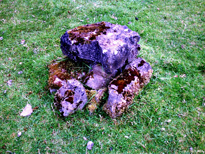
Above Image: Curious stone formation near South wall
This interesting old medieval parish Church lies a little off the beaten path.As with other parish Churches of the time its use would have diminished after the reformation although the graveyard surrounding it contains stones dating from the 18th to the 20th centuries some of which are weather worn to nearly ground level. It was not uncommon for the grounds of these old Churches to be used as burial places as the ground was already consecrated.
Hunting down old ruins like this is half of the enjoyment of the experience. This particular one is tucked away down a long country lane leading from a leafy part of the Grand Canal and is surrounded by pastureland. At the end of the lane is what appears to be a recently abandoned house and the entrance to a private estate, but a field gate on the left gives access to a farm track. A few metres down this track on the right you will find the Southern boundary wall for the ruins. They are accessed by a stile adjacent to a locked metal gate. The grounds appear to be kept in a reasonable state unlike some sites where you have to wade through waist high raptor grass and nettles.
The Church is situated on slightly elevated ground with a low bank and surrounding ditch. The Western and Eastern gables still stand to full height but the belfry on top of the West wall is crumbling badly so much so that I felt that if I knocked against the wall with any force the belfry would come tumbling down!
The Northern and Eastern walls have suffered badly and are really only partially standing on the Eastern end with debris of the rest of the walls strewn about. Still, the structure has an interestring aspect to it and seems to be a bit larger than the normal ruins of this type, so it would be quite interesting to get some more info on its history. All I can discover myself at this time is that the demesne on which the ruins lie were one part of Killybegs estate owned by the Dongans of Castletown. After the Cromwellian invasion the lands were held by Nathaniel Staughton but over time were restored to the Dongans and subsequently the Fitzgerald family . The house was roofless by the late 1950's and demolished some time later. There is no mention of the Church.
It was very quiet here on our visit only the distant Church bells in Clane wafting through the air. Its an isolated spot so we didn't expect to meet anybody and in fact we didn't.
To find the ruins take the Millicent Rd out of Clane Co Kildare, this is the road adjacent to the ALDI store. Keep on the road for approx. 3KM (You will pass Millicent Golf Club along the way) and drive until you cross a stone bridge spanning the Grand Canal. Take the first right turn after the bridge and almost immediately the next right turn. Follow this road until you reach another stone bridge. Cross over the bridge and turn left onto the road that runs parallel with the canal. Continue on until you have passed four house gate entrances and you will reach a lane way on your right that runs between two houses. At the end of this lane is a field gate on the left hand side. You can park here and the ruins are through the gate a little down on the right.


