Tuesday, 5 September 2017

Maiden Tower Co Louth


                        Above Image: The Maiden Tower with obelisk in backround

                          Above Image: The boathouse building and Maiden Tower

                              Above Image: Blocked up entrance to Maiden Tower

                                             Below 2 Images: The obelisk


These two unusual structures are situated at the estuary of the River Boyne at Mornington (town of the mariners) in County Meath. The taller of the two is called the Maiden Tower standing 60 feet in height.. It was constructed in 1582 during the reign of Elizabeth I who ascended the English throne in 1558. One of its main functions after 1585 was as a look out post in case of invasion by the Spanish Armada The origin of it's name is unclear. Some say it is in honour of Elizabeth who was known as the virgin Queen but the townland at that time was called Maydenhayes so this would also be a likely origin. Nevertheless it served as a navigational aid for ships attempting to enter the estuary. At night it would be a beacon and during daylight a navigator would know he was on track when the smaller structure disappeared behind the Maiden Tower.
The structures are accessible by a sandy track that leads to the rather stony beach. Apparently within the Maiden Tower a set of spiral steps leads to a barrel vaulted ceiling with an access point out onto the pararpets. A doorway which stands about 3 feet off the ground is now sadly barred up with a steel plate by the County Council as a result of vandalism to the tower in 2003. The original iron grill that blocked the door was forcibly removed  by a vehicle with tow rope for no other reason than pure vandalism and to infiltrate and cause damage to the interior.  To protect the tower from further harm it was closed to any public access.
We come now to the smaller structure which stands at 42 feet in height and is actually an obelisk of sorts. It was most likely used as described to act with the large tower as a navigational aid. It is local folklore that a lady awaiting the return of her mariner husband was viewing the ship's approach and on seeing the black sails which had been raised in error by the crew saw this as a signal that her husband had been killed. Quite distraught the lady threw herself from the tower to her death. It is said that the mariner who was still quite alive constructed the obelisk in her memory and it was called The Lady's Finger. That is the name to which it still known.
The building that stands adjacent to the tower was once a 19th century boathouse for the lifeboat service. This particular one ceased to be in 1926 falling into ruin thereafter. It was later refurbished to avoid more vandalism into a private dwelling but still daubings can be seen on a gable end one of them stating "The Mornington Mafia"
The tower and obelisk are well worth a visit especially on a clear day and with the backdrop of the estuary it's a very picturesque spot.
To find your way there take the M1 motorway heading North and exit at junction 7. Turn right at the roundabout at the top of the exit ramp and cross over the motorway taking the exit ahead on the next roundabout for the R132. Drive for approx 5KM and you will reach Julianstown. Continue through the village and drive another 3KM until you reach two roundabouts in close proximity. Take the right hand exit on the second roundabout onto the L1611 for Mornington. Continue on for another 3.5KM until you reach a stop sign at a staggered crossroads. (you will see a Texaco station ahead). Turn left at this junction and approx 400m along take the third turn right . This is called Tower Road. Just follow it until you see the entrance track to the Maiden Tower & Obelisk ahead. There is a height restrictive barrier for 2 Metres at the entrance but most.cars will fit under.and there's space beyond for a few vehicles. 


P.S. I have substantially updated the post on Bective Abbey in county Meath if you would like to check it out.

Monday, 21 August 2017

Leixlip Spa Co Kildare


                                  Above Image & Below Image; Access track


                                         Above Image: Steps leading to Spa


                                         Above Image: Trickle of spa water


                        Above & Below Images: Remains of Lengthsman's cottage


                                  Above Image: Steps leading down to waterfall

                                      Above & Below Images: The waterfall

                                   Image Below: Mouth of the aqueduct tunnel


This unusual site can be found adjacent to the Royal canal near Louisa Bridge in Leixlip.
In 1793 when excavating the land near the canal to build an aqueduct so that the canal could cross the Rye Water some of the workers discovered a hot spring with the water emanating at a temperature of approx. 75 degrees Fahrenheit.  William Connolly of Leixlip Castle (nephew of the famed “Speaker Conolly”) requested the Royal Canal Company to divert the spring water into a brick basin alongside the banks of the Rye Water. Connolly’s entrepreneurial mind envisioned a Roman style outdoor bath and commissioned its construction.  He was motivated by the success of the spring at Lucan which was discovered in 1758 and became very lucrative spawning a hotel at the site and thousands of visitors. The Leixlip Spa once constructed was indeed quite popular but the vision of a hotel never materialised especially following Connollys death. The spa was still in use over the years but by the 1960’s it had fallen into disrepair. A combination of committees and donations helped restore it somewhat and it was a feature in one of the late great Dick Warner’s Waterways documentaries in 2011 showing it then to be in good condition. Sadly now it has regressed, becoming a receptacle for litter and debris.and has also been daubed with graffiti
My curiosity took hold of me recently and I decided to take a look at this oddity. Free parking near Louisa Bridge seems hard to find so I just parked in the railway station car park and paid the fee. I crossed the road to the track the runs alongside the canal and found that a few yards down it split in two. I took the left hand track that runs away from the canal and after a short walk came upon the Romanesque bath in an area just below the grassy ridge I was standing on. A rudimentary set of steps led down to the bath. Unfortunately things have not improved and there was the remains of a fire that had been lit on the stone surround. It would seem that the site is unfortunately attracting more anti-social rather than social gatherings these days. There are two sets of stone steps on each end of the bath which are still in very good condition. This is such an unusual and pleasing remnant of the past and it would be great if it could be restored again. I’m sure if properly managed it would attract visitors to avail of what is said to be healing water.
I left the site following a track that led up through the bushes toward the canal pathway and here I found the derelict remains of the canal lengthsman’s house. This too was unfortunately defaced by graffiti. The Lengthsman would have be responsible for a stretch of the canal maintaining the water level. The run-off water was directed down the slope to the Rye Water forming a manmade waterfall. Water still runs off to this day and you can access the waterfall by taking the long set of  purposely built wooden stairs down towards the river. The area around the Rye water banks is of great ecological interest with some very diverse fauna to be seen.  In late summer and early Autumn be wary of the white flowered giant hogweed that is quite abundant near the river and make sure your skin does not come in contact with it and especially its sap which can cause serious burns.

To find the Spa take the M4 junction 6 exit heading north toward Leixlip. Follow on through two roundabouts and turn right on the second one onto the R149 and continue until you reach the bridge over the canal at the train station. Take the first right hand turn after the bridge and you will see the car park on your right. The fee for the day is €4.50. The Spa can be found on the opposite side of the road. Just follow the track alongside the canal and take the left hand fork a few yards down. 

Monday, 7 August 2017

Tullaherin Monastic Site Co Kilkenny


                                              Above Image: Entrance gate


                           Above Image & Below 2 Images: Interior of the church


                                       Above Image: The large Ogham stone


                     Above Image: The tower entrance now looks like a gaping maw


                                Above Image & Below 2 Images: Stroan Fountain


This monastic site is associated with St Ciaran the elder who on returning from twenty years in Rome founded a monastery at Saighir and also here in Tullaherin sometime in the 5th-6th century. While none of the original structures survive at Tullaherin the site was deemed very important and was built upon during the next few centuries. The incomplete Round tower we see today stands approx. 73 feet high and was constructed in the 9th century and as with most towers was designed to protect the monks and their valuables from marauding Vikings. The tower is missing its conical top and indeed shows evidence of leaning somewhat. St Ciaran is reputed to be buried here, some believe in  the vicinity of the tower. The large ruins adjacent to the tower are of an 11th or 12th century Church which was added to in the 1400’s by the construction of a chancel. It is divided into two sections. After the dissolution the Church changed hands to serve the Protestant community and was greatly renovated in 1616. However, the 1837 ordnance survey map lists the church as being in ruins.
The site is very impressive. It is somewhat off the beaten track but is well worth a visit. We were directed here whilst visiting nearby Kilfane Church (see post here) by a local man binging his kids to see the magnificent medieval Knight effigy. We later ran into them again at Tullaherin. A combination of both places makes for a really rewarding journey.
Two Ogham stones were discovered here in the past one of which was removed from the site and rediscovered in the 1980’s propping up a gate on nearby lands. It was brought back to Tullaherin and placed adjacent to the South wall and close to the base of the tower. It still has some inscriptions upon it but they are fairly illegible.
I’m not sure if there is work going on here at the moment but there are warning signs placed on the church ruins to avoid entering the ruins. However you can pretty much get around what you need to see.
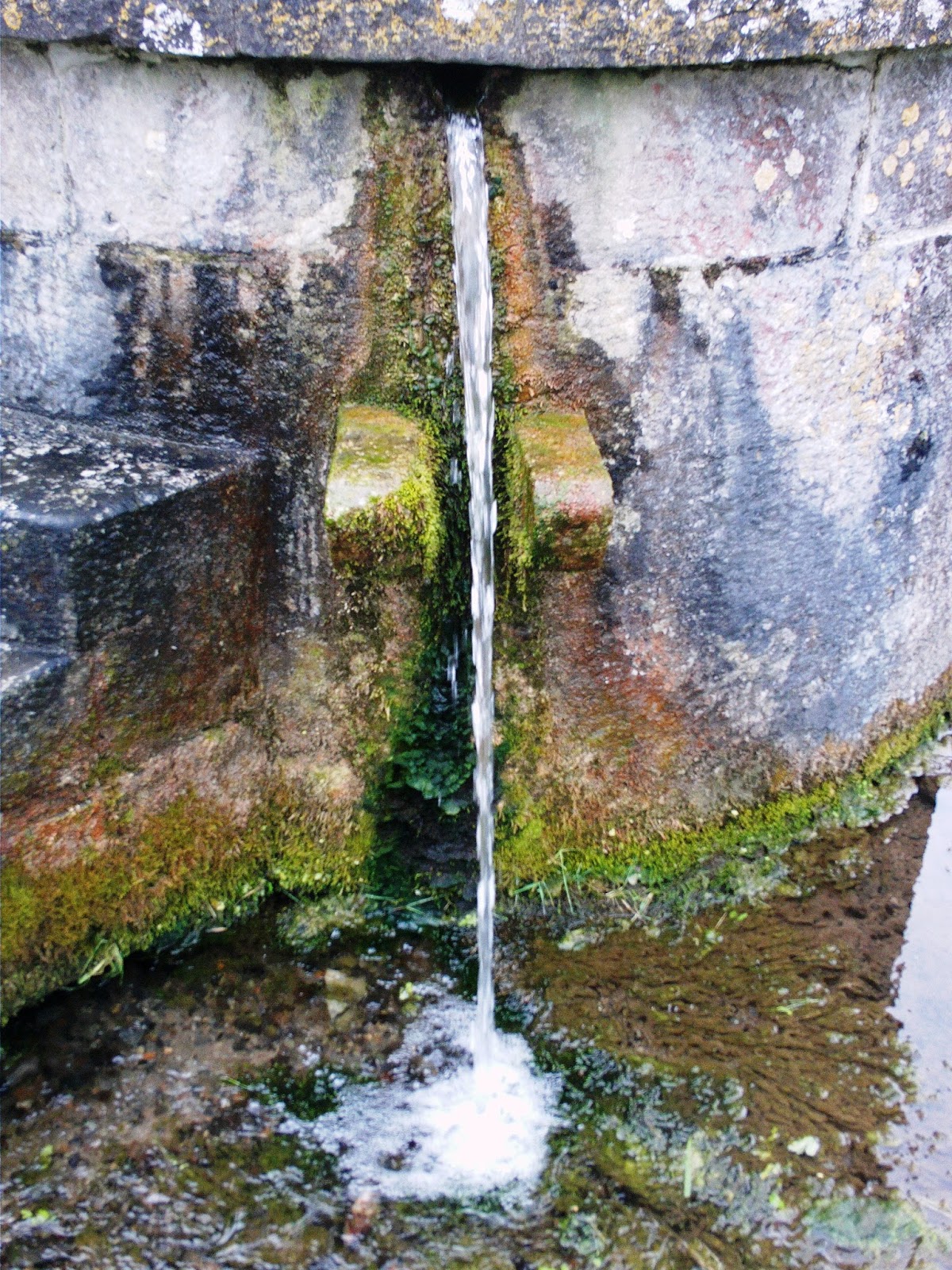
Two asides of interest. The first is the existence here of a cillin which is a rather sad thing to encounter. It is basically a kind of potter’s field for children. A mass burial site where unfortunately deceased and unbaptized infants were buried. This was usually situated nearby the consecrated graveyard but still outside the walls leaving them in some respect divorced from the normal populace. It was a common practice in early Ireland and there are numerous examples around the country. Very sad indeed. The other item of interest is on one of the approach roads to Tullherin. It is an ornate fountain called the Stroan fountain It was commissioned by Colonel Bushe of Kilfane House in 1766 using local limestone. Its purpose was to supply water to the tenants of his estate. It is aesthetically pleasing to the eye and was renovated but unfortunately the tantalisingly clear water flowing from it has at the moment a warning not to consume direct from the fountain due to bacteria present. Hopefully this will be resolved at some stage. 

Take the M9 heading South and exit at Junction 7 and at the top of the exit ramp take the left hand exit for the R448 (signposted for Thomastown). Continue straight through the next roundabout and on the subsequent roundabout turn right on to the continuance of the R448. Continue on through the villages of Gowran and Dungarvan and approx. 4KM out of Dungarvan you will find a right hand turn. Unfortunately there are no direction signs but if you pass the Long Man restaurant & bar on your right then you need to turn and go back approx. 500m and take the first left turn. Follow this road for approx. 1.75KM and you will reach a crossroads at Tullaherin Church. Turn left and you can park in the car park of the modern church. The monastic site is directly opposite. 

Wednesday, 26 July 2017

Coolbanagher Church Co Laois


                                              Above Image: Entrance gate


                                             Above Image: Entrance door            

                                         Above Image: Restored central arch


                                            Above Image: The cross slab


I side tracked to this interesting ruin while in the vicinity visiting Morett castle (see earlier post here). These are the remains of a medieval church constructed on the site of an early Christian monastery. The ruins after excavation and renovation in the early 1990’s revealed a construction of several phases the oldest part being of early Christian era with later extensions that included a Chancel in the Romanesque style and even later renovations constructed in the Gothic style. The church remained in use even after the dissolution. On February 2nd 1779 when it was then under the name of St Peter’s and serving the protestant community the thatched roof was set alight burning the church badly. A new and larger Church was built between 1782 and 1785 and subsequently the old church found itself utilized as a farm outbuilding. It was listed on the 1837 ordnance survey map as being in ruin at that time.
The ruins are situated in a very pastoral setting surrounded by meadows and access is easy enough by way of a small iron gate by the roadside. All of the walls and gables are extant and access to the interior is now possible whereas in the past the windows and doors had been blocked up. A clean up was done on the site but the overgrowth inside appears to be taking hold again. The structure consists of a chancel and nave and is quite long at 62 feet. It is approx. 22 feet in width. Entry point is the Romanesque door possibly dating to the 12th century that is positioned in the West facing gable. The once Romanesque dividing arch has only the original base extant but the arch has been restored for some unknown reason in the Gothic style. One interesting little remnant can be found on the interior of the North wall adjacent to the East gable. It is an early Christian cross slab which was removed from its original spot and placed securely on the wall during renovation
Coolbanagher was positioned on the road of the assemblies an important medieval route that stretched between the ancient provinces of Mide and Munster. St Aengus the renowned 9th century Bishop and scribe is said to have stopped at Coolbanagher during a journey and whilst there was inspired to write the Félire Óengusso a register of saints and their feast days.
As a small aside a few metres down the road from the church until recently stood the huge ruin of Coolbanagher Castle. A tall tower house, It was located in the grounds of a private residence but partially collapsed during a bad storm in 2014. It was subsequently demolished and all that unfortunately remains now is a large pile of stones.

To find the ruins head West on the M7 and take the junction 15 exit signposted for Mountmellick. At the top of the exit ramp take the right hand exit of the roundabout which crosses back over the M7. Go straight through the roundabout on the other side and at the subsequent roundabout turn left again following the sign for Mountmellick. Approx 250m on you will reach another roundabout which you go straight through. Continue for approx. 1.8KM and take the third right hand turn (this narrow road is at an angle to the main road). Drive down this road and after approx. 1KM you will reach a crossroads. Go straight across and drive another 600m until you reach a T-Junction. Turn right and approx. 200m on you will spot the ruin on your left. You can park at the verge at the entrance gate. 


Wednesday, 12 July 2017

Morett Castle Co Laois


                                            Above Image: Field entry gate

                                         Above Image: Remains of East wall

                                 Above Image: View of the North East bartizan

                                Above Image: Possible remains of an entrance


                                 Above Image: The jagged South West remains


I have passed by this dramatic ruin countless times on the M7 but an opportunity recently afforded me the chance to leave the motorway and find the back roads leading to it.
The castle was a huge late medieval residential tower house built by the Fitzgerald's in 1580. Within 200 years it would be abandoned. It stood four storeys high and had semi-circular bartizans on each corner. Several fireplaces on some levels were represented at roof level by four huge chimneys which are still extant.The castle came under attack by Cromwell's forces in 1641 and was forfeited.but eventually returned to the Fitzgerald's in 1660. One oft told tale recounted in depth by Sir Jonah Barrington in his volumes "Personal sketches of his own times"published in 1830 was that of Elizabeth Fitzgerald who in 1690 found herself besieged in the castle by the O'Cahills who had managed to take her husband hostage and threatened his life if she did not render the castle to them. Staunchly defiant Elizabeth proclaimed "Elizabeth Fitzgerald may get another husband but Elizabeth Fitzgerald may not get another castle; so I'll keep what I have; and if you don't get off faster than your legs can readily carry you, my warders will try which is hardest, your skull or a stone bullet" The castle remained intact and in her possession but her unfortunate husband found himself dangling from a gibbet!
An illustration by Francis Grose from his antiquarian tour of Ireland in 1791 depicts the castle in ruins with all walls standing but the roof missing. What caused the massive crumbling that has taken place over the last 200 years is debatable but it has left two tall shards jutting upwards to the sky. The remains existing today consist of about two thirds of the East wall and North East bartizan, a small portion of the North wall and the corner of the South and West walls with its bartizan.
Back to the visit. We found that the ruins were in fact built upon a rocky outcrop that was now on private land. A Nicely built modern house stood in front of them. When we arrived we planned to simply knock on the door and seek permission as there were "No trespassing" signs on the pillars of the entry lane that led to the rear of the house. To further upset our plans there were several temporary signs placed directing traffic towards a funeral gathering it would seem at the house..Bad timing for a visit it would appear. However we did get an answer at the door by a very charming lady who dressed in black and heading for the said funeral still graciously allowed us entry to view the ruins as she said herself that she had a great interest in things historical.
Up the lane way to the right of the house we found a field gate which was unlocked and access was easy. The ground within is overgrown and slopes downward from the ruin.The surrounds showed several signs of dislodged rock from the castle walls so we took some very careful steps on our ascent to reach the interior. Standing within you could really get a sense of the original size of this castle and how strategically it was placed..Remnants of the fireplaces and even an oven area are still visible but the features have been ravaged by time. A nearby castle at Coolbanagher which had been a similar tall strong tower almost totally collapsed during a bad storm in 2014 and was eventually demolished. How Morett in its current state survived that storm is a puzzle but there you have it, the fickle hand of fate. That aside I feel that unfortunately time will eventually take its toll and we will sadly lose this striking structure from the landscape..
To find the ruins head West on the M7 and take the junction 15 exit signposted for Mountmellick. At the top of the exit ramp take the right hand exit of the roundabout which crosses back over the M7. Go straight through the roundabout on the other side and at the subsequent roundabout turn left again following the sign for Mountmellick. Approx 250m on you will reach another roundabout which you go straight through. Drive for approx. 1.3KM and you will reach a left hand turn. Turn left and after you have crossed over the motorway again take the second left hand turn. This is a Cul-de-Sac with a modern house on the left at the top. You can park here and seek permission for entry to the ruins at the house.   . .