A guide to the best and sometimes off the beaten track historical ruins around Ireland and how to get there.
Friday, 24 May 2019
Old Nobber Church Co Meath
Above Image: The Cruise grave slab
Above Image: The West wall & belfry
Above Image & 2 Images Below: Some possible ancient grave markers
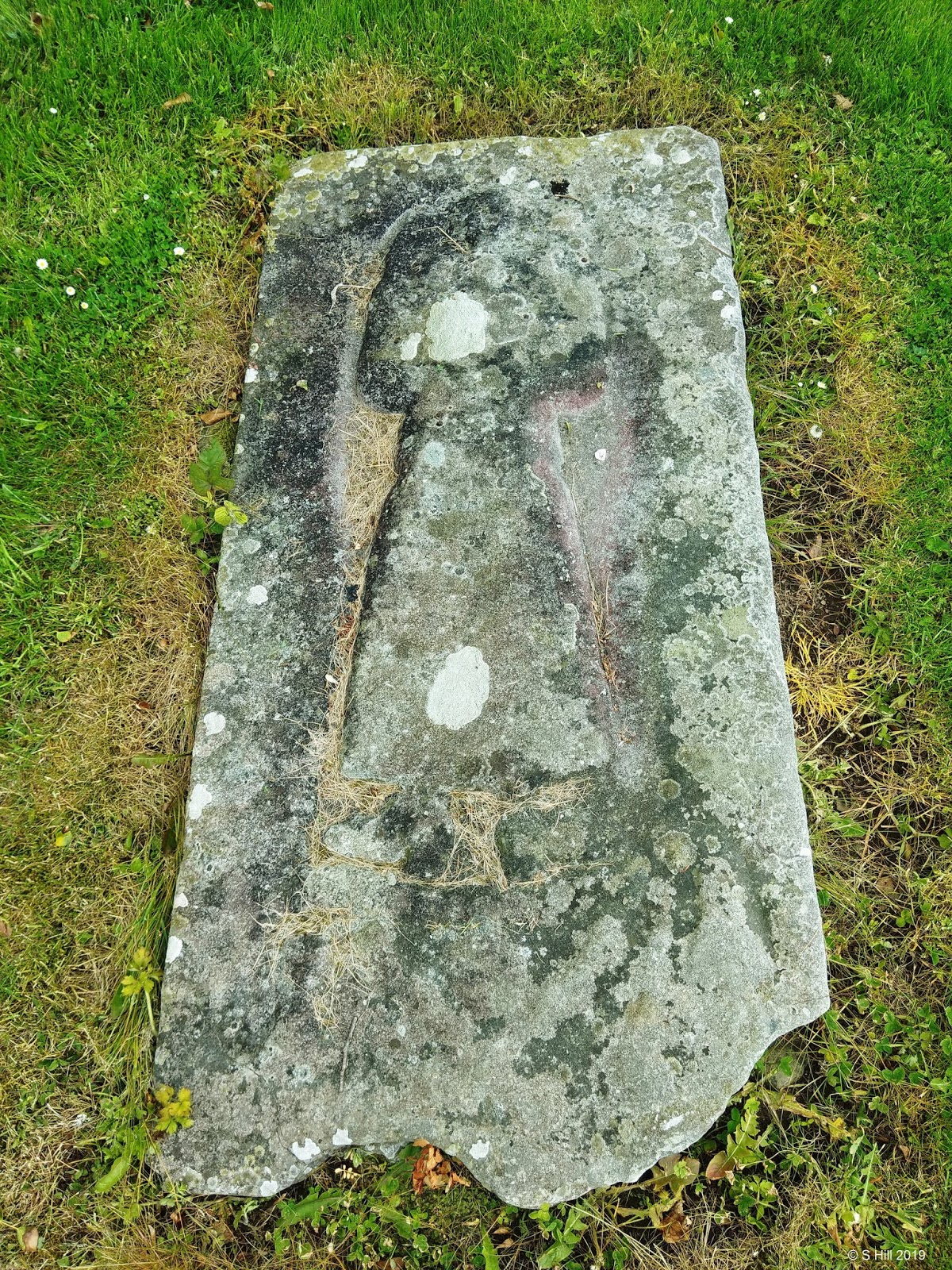
Above Image: Edward Balfe grave slab
Above Image: Grave slab of Murtagh the priest
Very little remains now of the medieval parish church in Nobber Co Meath. The name Nobber is derived from the gaelic "An Obair" meaning "The Work". The church was built on a former non-extant monastic site and was dedicated to St John the Baptist. During the middle ages the parish of Nobber thrived but by the 17th century it had slipped into decline and the church was ruinous by 1641.
All that is left standing today but still looking dramatic is the West wall and belfry tower which was added to the church in the 15th century. With the innards now exposed it shows that the ground floor was vaulted within the tower. Originally it consisted of four storeys. A fragment of the North wall is also present..
On our visit we got talking to a local grounds warden who was very informative and pointed out the grave slabs present at the site. The most striking is that of the effigial tomb slab of Gerard Cruise and Margaret Plunkett which was once within the old church but has now been set upright in a monument in the car park. There are two other slabs to be found in the graveyard date to the late 17th century one of them belonging to a priest called Murtagh the other to one Edward Balfe. The graveyard contains many interesting ancient stones and high crosses and is well worth a walk around. The more modern building adjacent to the ruins is that of a Church of Ireland church built in 1771 is now closed for worship but has been transformed into the George Eogan Cultural & Heritage Centre.
To find the ruins take the M3 heading North and after junction 10 the motorway ends in a roundabout. Take the third exit on this roundabout then the first exit on the subsequent roundabout following the N52 for Dundalk. Drive straight through the next two roundabouts and on the third take a left turn still following the signs for the N52 to Dundalk.Continue on this road for approx 12KM through Carlanstown and Stahalmog until you reach a T-junction with the R162. Turn left here and drive for approx 4KM until you enter Nobber..Look for Keogan's Bar on you left and turn left up the laneway just before the bar. You will find the car park of the graveyard at the end.
Sunday, 12 May 2019
Castledermot Monastic Site Co Kildare
Above Image: Entrance stile
Above Image: The Romanesque arch
Above Image: The Southern cross
Above Image: The Northern cross
Above & Below Image: The hogback grave
Above & Below Image: The swearing stone
Above Image: Second smaller marker with a hole
Above Image: Possible part of a font?
Above Image: Small ancient cross
Above Image: Possible foundations?
Above & below Image: The round tower
Above & Below Image: Unusual font
This is a very interesting site located on a back lane in the village of Castledermot.This was once a self contained monastic site originally founded in 812 A.D.and it still contains some ancient remnants.
The 10th century round tower now has a castellated top instead of its original conical one, It stands approx 65 feet high and unusual for a round tower has its doorway only slightly above ground level.
It stands adjacent to the more modern Church of St. James which itself incorporated some of the masonry from the original medieval church.
Within the grounds are two of the original high crosses dating from the 9th century one on the North side of the church, the other on the South side. To my eyes the Southern cross is the more decorative of the two and stands at approx 6 feet high.
We visited this site on a bright sunny day and it was a pleasure to stroll around the grounds. Access to the grounds is by way of a quite narrow stile and I found it a bit of a squeeze, The gates remain locked so it was really the only way in,
Apart from all of the above there are several other interesting and unusual things to see,
Just South of and adjacent to the Southern cross is a hogback grave stone, This is the only one of its type in the country and is said to resemble the shape of not only a hogs back but a Viking long hall,
Just North of the Southern cross is a gravestone with a hole in it. There is a larger one East of the Southern cross which is locally known as the "swearing stone" and it said bargains were struck by both parties shaking hands through the hole.
The graveyard appears to be littered with various unusual stones and an interesting font located near the fine Romanesque arch which was a doorway to the medieval church.
We spent quite a while here wandering around and were not disturbed by anyone. If you visit you are likely to have the place to yourself.
At the other end of the village are the ruins of the old Abbey (see earlier post here) which you could incorporate in your visit,
To find the monastic site and its ruins take the M9 motorway and exit at junction 3 and take the R747 heading East, Drive for approx 2KM until you reach a T-junction with the R448. Turn right onto the R448 and continue on this road for approx 11KM until you enter Castledermot. Look for Doyle's pub on your left and take the left hand side lane way just beside it. This is called Church Lane, You will find the site about halfway down on your left. There is room to park at the graveyard wall.
Friday, 12 April 2019
Old Fontstown Church Co Kildare
Above Image: The entrance stile.
Above Image: Interior and East gable.
Above Image: Exterior of East gable.
Above Image: West gable door and belfry
Above & Below Images: Exterior & interior of doorway
Situated in the area of Fontstown lower the ruins of this small parish church sit in a well kept graveyard. The ruins however appear to be in a fairly bad state and infested with ivy and other vegetation.
The origins of this site date back to 12th century Anglo-Norman times where a medieval church was sited here and referred to as 'Villa Fonti' but is recorded as being in ruins by the end of the 13th century.
The extant ruins here today are of an 18th or early 19th century church with partial segments of its walls possibly dating to the earlier church. It is a very plain structure with a damaged doorway in the West gable that also sports a bell cote which is also damaged. Within it is quite overgrown and we had to tread carefully while inside the walls. Nonetheless it is a atmospheric spot and very tranquil. The usual cacophony of crows was curiously absent at this site. A local informed me that there was a children's burial site here but it could not be pinpointed. He also told me that there is supposedly a tunnel or Souterrain under the graveyard.
If in the area you could also take in two more ruins in nearby Nurney see earlier posts here and also here.
This site is quite easy to find. Take the junction 2 exit from the M9 and join the R448 Westbound signposted for Castledermot. About 700m along the R448 becomes a turn to the left but you continue straight past this and the road becomes the R418. Drive on for approx 10KM until you see a right hand turn with a sign pointing to the R415 to Kildare. Turn right here and the ruins are about 50m along on your left. There is room to park at the cemetery walls. Access is by a stone stile.
Sunday, 17 March 2019
Donnelly's Hollow Co Kildare
Above Image: The roadside signpost
Above Image & Below 3 Images: The monument
Above & Below Image: The giant footprints
We came across this interesting oddity on a recent ruin hunt. Donnelly's Hollow derives it's name from a man called Dan Donnelly (1788-1820). The original name of this hollow was Belcher's Hollow but it was renamed in honour of Dan and his exploits here.
The Hollow like many in this beautiful area of The Curragh in Co Kildare forms an almost natural amphitheatre and was the perfect spot for an event in 1815.
Dan Donnelly had a reputation as a hard drinker and well able to hold his own in a brawl. A bout in a coffee shop brought him to the attention of Captain Kelly a local horse trainer who saw potential in Donnelly and so set him up training in Kilcullen as a boxer. His first recorded fight was against a prominent boxer Tom Hall in September of 1814 and it ended after 20 minutes in controversy and was eventually deemed a draw. His second fight is his most famous and took place in Belcher's Hollow with 20,000 spectators coming far and wide to see him beat English boxer George Cooper. Donnelly's triumph was seen at the time to be a torch for nationalism and made him famous. His fame however over the following few years saw him being the target of fraudsters and he eventually died penniless in 1820. His body was buried in Bully's Acre in Kilmainham, Dublin with an attending crowd of 70,000.
The story takes a weird turn when his body was stolen by graverobbers and ended up in the hands of an eminent surgeon named.Hall, who wanted to study the muscle structure of this famous pugilist.The surgeon removed the right arm and had Donnelly's body reburied. He took the arm to Scotland where it remained for several years until it was purchased by a carnival and displayed in a "Peep show".
The arm found its way back to Ireland and was eventually procured by a sportsman called Tom Donnelly who donated it to "The Hideout" pub in Kilcullen where it was macarbrely displayed in a glass case for many years. It drew a lot of custom to the pub but when the pub was sold in 1997 the arm was removed by the former owners Des and Josephine Byrne to protect it and it is now in the private ownership of Mrs Byrne. The current owners of the pub are still seeking to have it put back on display but nothing has come of it yet.
The monument that now stands on the spot of the Donnelly-Cooper fight states he was born in 1770 but this appears to be incorrect as most records state his year of birth as 1788.
Standing on the roadside and looking down into the hollow you can really sense how perfect a theatre this was for the event. We visited on a day in march that certainly had many weathers. Shortly after we left we were caught up in a hailstorm of biblical proportions which could have been most unpleasant if we had still been down in the Hollow. You can spot the incoming cloud in some of the photos.
Leading uphill from the monument are a series of approx 45 indentations in the ground which look like footprints. Legend has it that ardent followers of Donnelly dug out the footprints left by Donnelly as he strode victoriously upwards after the bout. They are still here today and it is custom to follow them up although some can be difficult at times. Donnelly was a giant of a man and these are also a testament to him. We moved on to our ruin hunting and after the storm we regained sunny weather thankfully but I'm glad we took time to visit here.
To find Donnelly's Hollow take the M7 motorway and exit at junction 12 onto the R413 for Athgarvan. Drive for approx 600m and you will pass through Lumville Cross. 500m later you pass through a smaller crossroads with the L7043. Approx 150m onwards look for the signpost on your right for Donnelly's Hollow. There is a small parking area here on the right hand side.
Thursday, 28 February 2019
Balrothery Tower and Castle Co Dublin
Above Image: The entrance gate
Above Image: The seemingly round tower on the right is
actually a spiral staircase
Above & Below Images: Part of a font and what appears
to be a some sort of stocks.
Above Image & Below 2 Images: The overgrown smaller
castle tower
Balrothery was basically founded when the Norman Robert de Rosel was granted the lands there and built the town. Balrothery translated means "Town of the Knights". The two towers that are extant here were thought to have been built circa 1500 but there is a print from 1890 by the artist J. S. Fleming which depicts both towers and dates them at 1343. Where the artist got this information is unsure. However the larger tower although partly ruinous is in very good shape and a church was added to it in the 19th century but is now out of use.The smaller tower is blocked up and overgrown with bushes and trees on private ground and is inaccessible.
When we first arrived we were impressed how imposing the tower looked sitting atop the hill and couldn't wait to get a closer view.
The churchyard is easily accessible and the tower really does dominate the site. What appeared to be a round tower on the North West corner I believe is not the case. It is in fact a turret with an internal spiral staircase and it tapers in size as it nears the top.
The tower is a three storey structure and has windows on all four walls on the top storey and a bell cote was added for church purposes on the East side.
There are a few oddities alongside the church wall such as a the top section of a font and what looks to be a set of stocks. What significance the stocks have here I have no idea.
Adjacent to the big tower a smaller tower lies hidden by trees and bushes on private land. We tried to get as close as we could up the laneway beside the churchyard but it is so overgrown in there. This tower although supposedly a four storey structure is not as tall as it's neighbour and is now blocked up. A pity.
To find the towers take the M1 heading north and exit at junction 5 for the R132. At the top of the ramp turn right on the roundabout and cross over the M1 Go straight through the roundabout on the other side and drive about 200m until you reach yet another roundabout. Follow the signs for the R132 to Balbriggan. Drive for approx 3.5KM until you enter Balrothery. You will spot the tower on the hill on your right. A little further on is a turn into the Balrothery Inn. You can park in the car park here and walk across to the tower.
P.S. I have updated the post on Kindlestown Castle Co Wicklow as we made another visit recently. You can find the post here. We also paid a second visit to Old Killadreenan Church. You can find the update here.
Subscribe to:
Posts (Atom)


